Smuggler's Glory
You see, while Vitus Bering and company were adventuring in the North Pacific, Joseph de L'Isle (of The General fame) was far from St. Petersburg himself: he was off in Siberia observing the transit of Mercury. One of his rivals at the Academy decided to take advantage of his absence to accuse de L'Isle of having spent decades smuggling secret documents and particularly maps to France. Joseph was booted from the Academy in 1747.
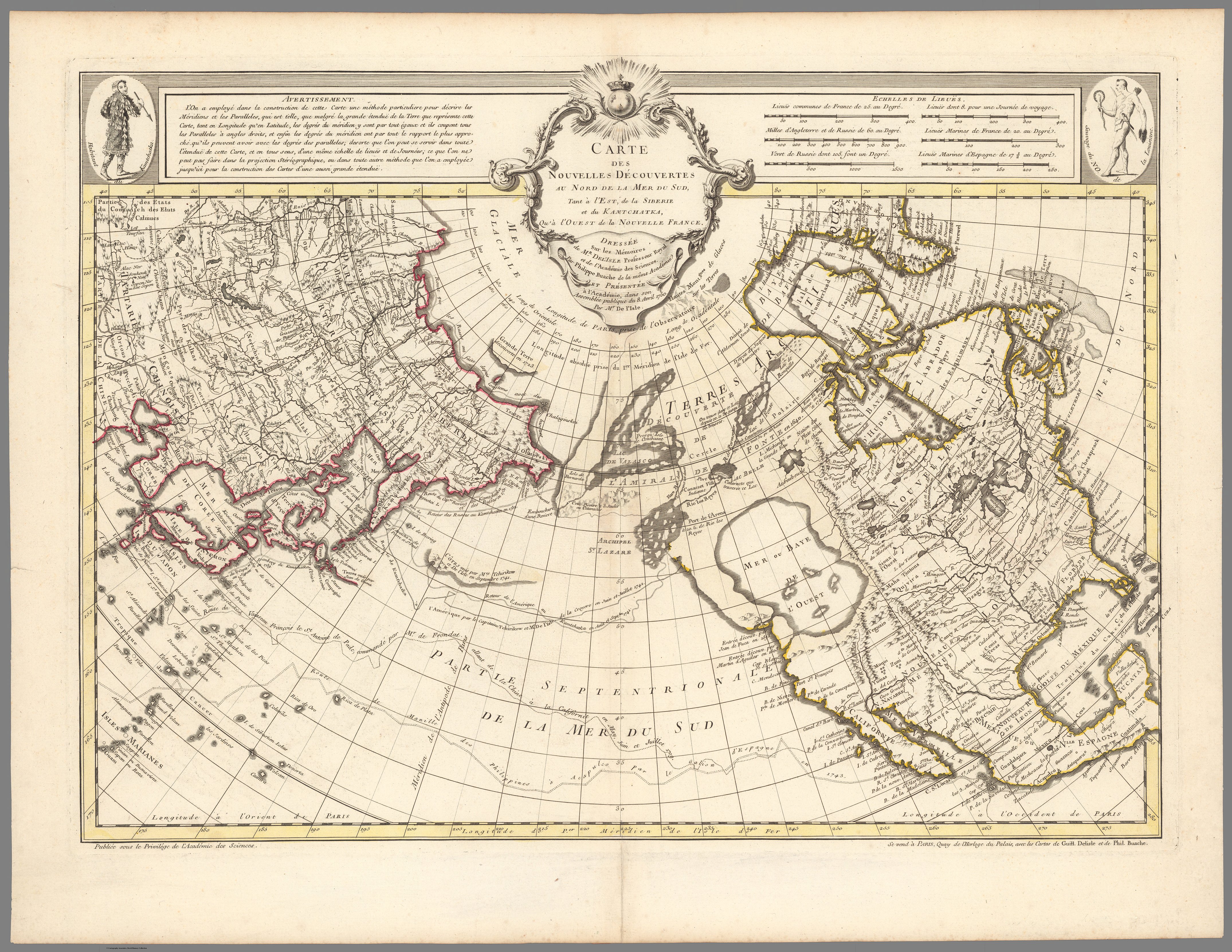
He returned to Paris, but he did not go empty-handed. In 1750 he executed one of his greatest feats: he presented a map of the North Pacific showing the discoveries of the First Kamchatka Expedition based on information that the Russian Imperial Academy of Sciences believed they had under lock-and-key. Two years later, he published it.
The map is full of curiosities, such as the "Sea of the West," which Joseph dreamed up, and a rather sketchy description of the North American coast.
The Russians were furious, both with the act of espionage and with what they described as de L'Isle's egregious mistakes. So they did what any self-respecting empire would do: they commissioned a different cartographer to make a new map. To issue a retort.
The cartographer's name? Gerhard Muller.