The Imperiia Project: a spatial history of the Russian EmpireMain MenuProjectsDashboardsData CatalogMapStoriesGalleriesGamesWho said history was boring?Teach Our ContentCiting the ProjectKelly O'Neilldc20b45f1d74122ba0d654d19961d826c5a557f5The Imperiia Project // Davis Center for Russian and Eurasian Studies, Harvard University
Muller Retort
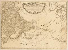
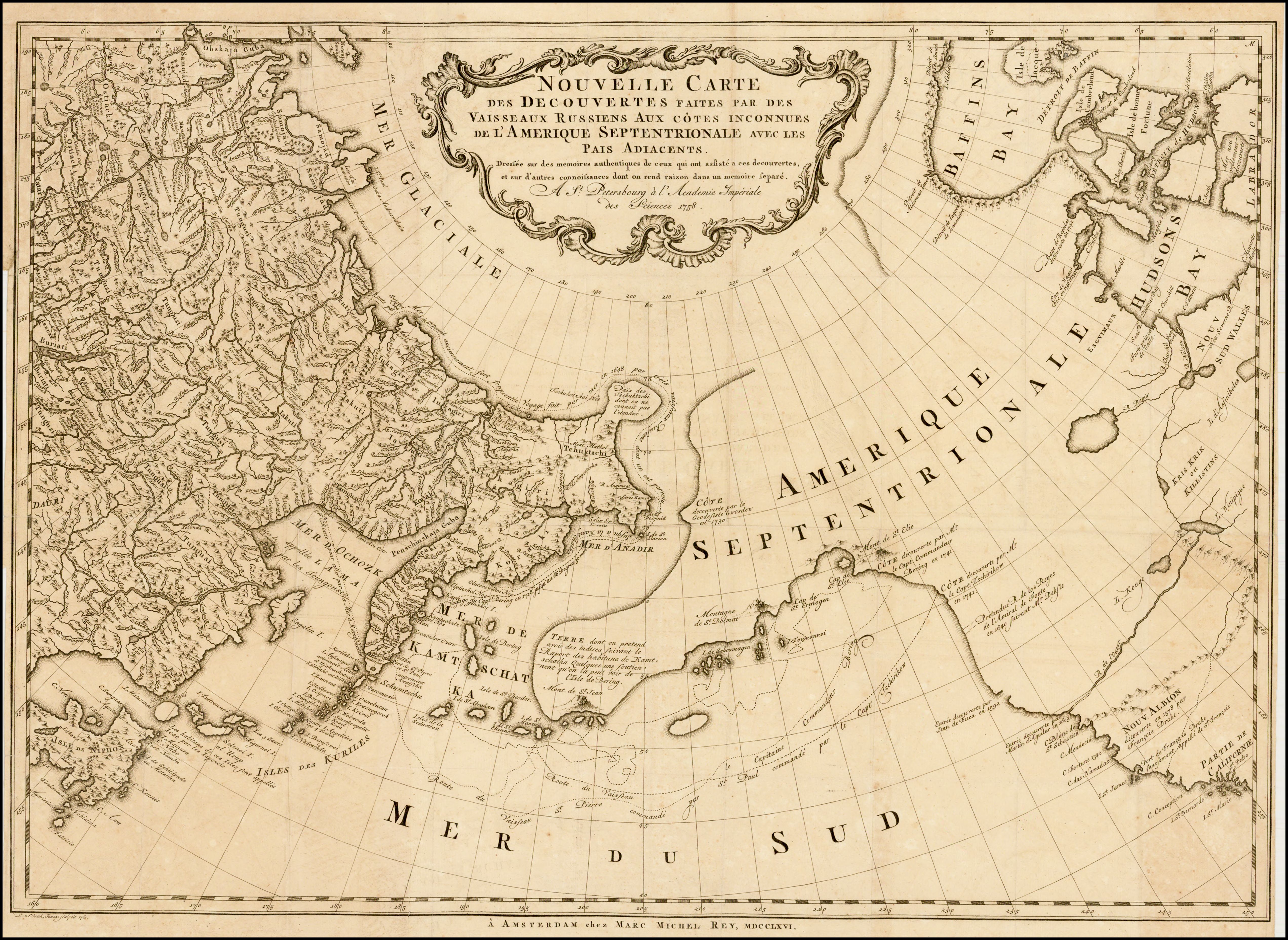
12020-05-01T04:23:56-04:00Kelly O'Neilldc20b45f1d74122ba0d654d19961d826c5a557f597In which an imaginary sea becomes an imaginary river, and Kamchatka more or less remains intact.plain2020-05-05T13:51:24-04:001758Kelly O'Neilldc20b45f1d74122ba0d654d19961d826c5a557f5This is a Dutch edition of the map made in 1754 by Gerhard Muller (co-founder of the Academy of Sciences, father of Russian ethnography, court historian, and member of the Second Kamchatka Expedition, but NOT a cartographer by training) to refute the treasonous map published by de L'Isle in 1752. Muller's work was immediately recognized as accurate and authoritative (though you may beg to differ). The map was widely circulated and reproduced by French and English mapmakers for decades.
12020-05-01T04:51:11-04:00Muller Retort2Full Title: New Map of the Discoveries made by Russian Voyages to the Unknown Coasts of North America (Nouvelle Carte Des Decouvertes Faites par Des Vaisseaux Russiens Aux Cotes Inconnues De L'Amerique Septentrionale) // Russian Imperial Academy of Sciences (St. Petersburg, 1758) // Barry Ruderman Map Collection. Catalog permalink: https://exhibits.stanford.edu/ruderman/catalog/nm443tv3289plain2020-05-01T04:52:12-04:00