Siberian Sketchbook
9
a geospatial archive of seventeenth-century Siberia
image_header
2024-03-11T10:48:12-04:00
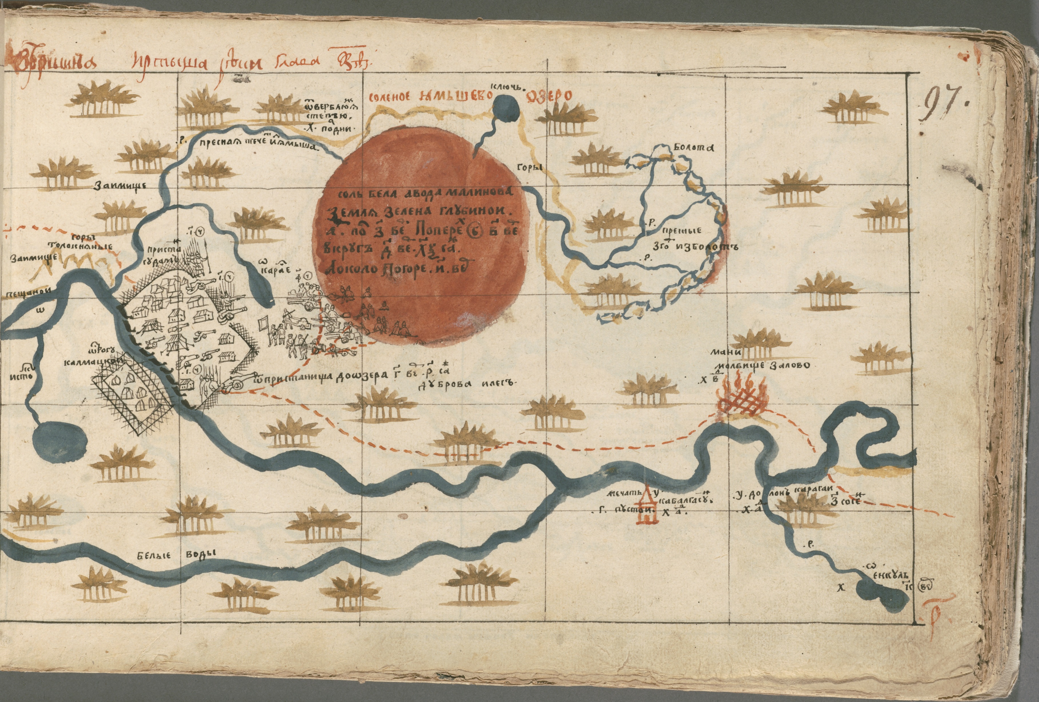
We are building a geospatial archive seventeenth-century Siberia. The source of this archive-under-construction is a gorgeous manuscript atlas produced in 1696 and now housed in Harvard’s Houghton Library. The 163 maps Semyon Remezov created and bound into his Khorograficheskaya Kniga (Chrorographic Sketchbook) describe feature topography, vegetation, mineral deposits, the prevalence of wildlife, and details about trade routes and travel conditions. If you want to locate poisonous fruit, lucrative hunting grounds, or the best route over winter ice, Remezov's atlas - and the database we are building from it - is for you. Why we are excited (and why you should be)
- We want to compare the river systems and land use patterns of the past to those of the present. However, forcing satellite-generated data to play nicely with hand-painted descriptions of oxbows isn’t easy. We are developing a strategy that will bridge the gap between cartographic methods.
- Our method for grid-based feature extraction will be useful to anyone working with map series describing any part of the world.
- Sometimes, maps aren’t enough. This project demonstrates the complementary power of geospatial, thematic, and network visualization.
Take a look behind the curtain
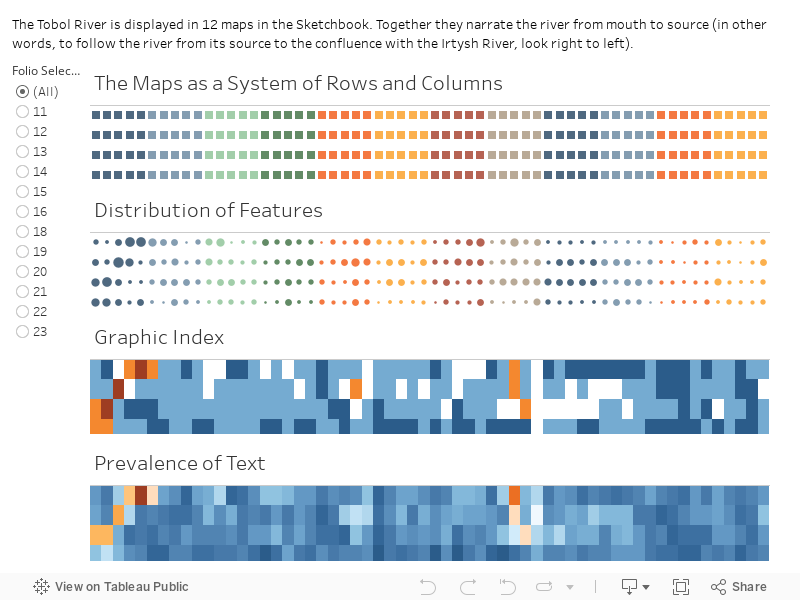
Visualizing the contents of 163 maps describing 24 major rivers (along with hundreds of others) spanning half a continent in one visual plane is no easy task. And did we mention that the maps vary constantly in scale, projection, and orientation?
In an effort to tame this cartographic beast, we harnessed the power of the drafting grid Remezov used to compile his maps. By breaking each sheet into a series of grid squares we can preserve the sequential logic of the maps and allow researchers to filter and query. To get a sense of how this works, explore this visualization of the 12 maps of the Tobol River. Use the folio (i.e. map) selector on the left to see how the distribution of features, graphic elements (including symbols and color variation), and text elements (including placenames and notes) vary.
See what you can make of these maps: choose your own adventure: