The Imperiia ProjectMain MenuResearch Dashboardsmaps, visualizations, and moreVeles: The Data CatalogOngoing ProjectsThe MapMaker PodcastEvery story starts somewhere.Teach with MapsGalleriesKelly O'Neilldc20b45f1d74122ba0d654d19961d826c5a557f5The Imperiia Project // Davis Center for Russian and Eurasian Studies, Harvard University
Not quite the same
12020-04-02T13:17:41-04:00Kelly O'Neilldc20b45f1d74122ba0d654d19961d826c5a557f591plain2020-04-02T13:17:41-04:00Kelly O'Neilldc20b45f1d74122ba0d654d19961d826c5a557f5The Russian Empire isn't exactly the same thing as the Russian Federation, which is the country you will find on Google Maps, but that's okay. Let's just call them both "Russia" for now.
What can you learn from a map that is 300 years old and written in a language you (most likely) cannot read?
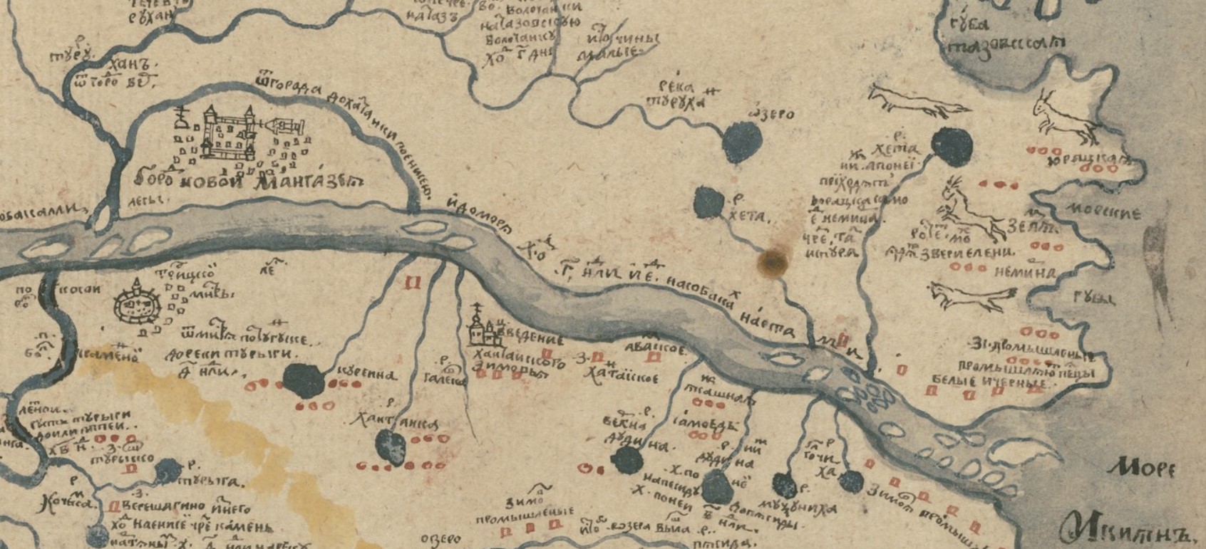
The map in question was made in Siberia. It shows one of the coldest, most remote parts of what was the Russian Empire. The only copy ever made is now in Houghton Library in Cambridge and you can flip through every page of the full atlas by clicking here.
The official name of the map is "Map of the town of Mangazeya and surrounding area," but we prefer to think of it as the "Wild Things" map. It won't take you long to figure out why. All maps tell stories, but this particular map never stops telling them - stories about fires and polar bears and dogsleds and more.