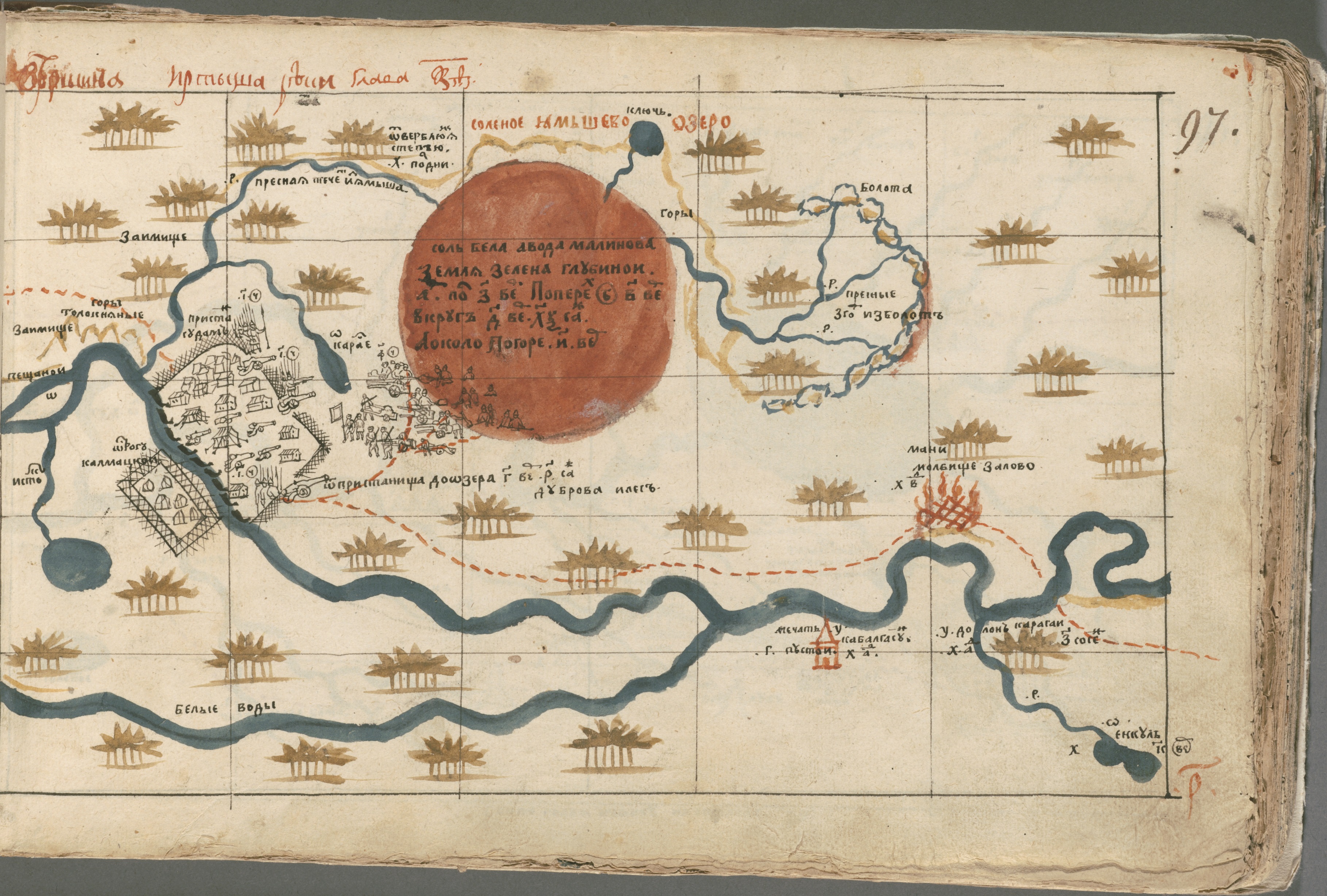
Secrets of the Salt Lake: 1 map, 3 challenge levels
A good map tells stories. (And this - we promise - is a good map.)
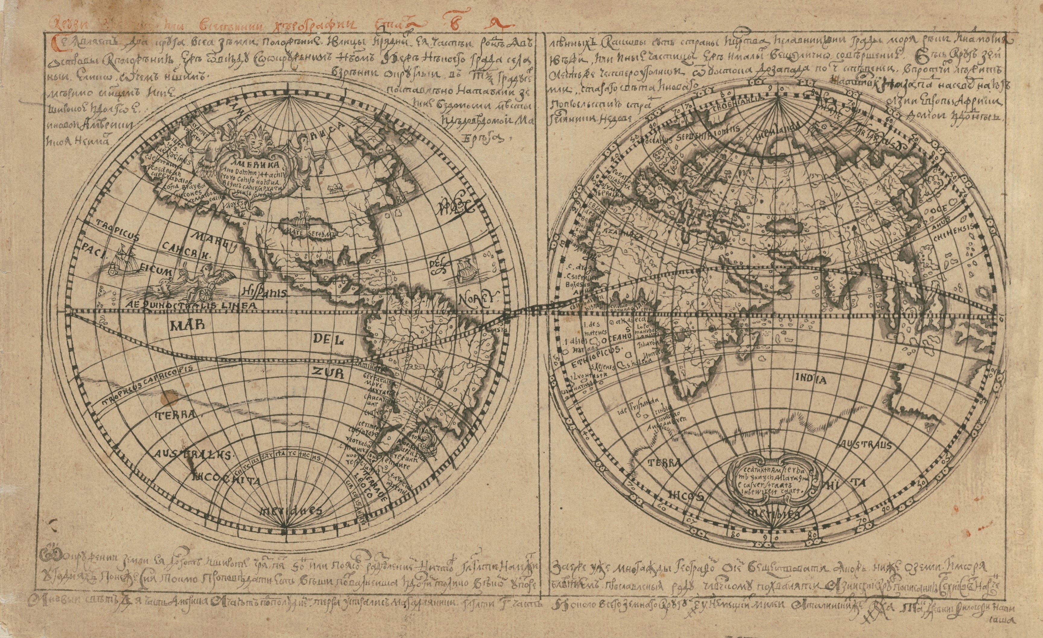
It comes from an atlas made in 1697 in the town of Tobolsk. The atlas is the work of a man named Semyon Remezov - an icon painter, historian, and geographer. One year earlier, Tsar Peter I (yes, Peter the Great) issued a decree calling for the production of an atlas of Siberia. Why? Well, the Russian tsar wanted to be able to "see" the territories he ruled from his palace in St. Petersburg, and a map was really the only available tool for that purpose.Of course, since Siberia stretched from the Ural Mountains all the way to the Pacific Ocean, this was one tall order. Remezov was the only man in the empire capable of the task and he devoted himself to the task, revising and copying his work for years. But he produced the core set of maps within a year and bound them together into his Chorographic Sketchbook. It contains 163 sheets of maps and plans. The Sketchbook has a fascinating history of its own, but in the end it landed at Houghton Library in Cambridge, Massachusetts.
Let the fun begin.
You are welcome to use the map view below, but we highly recommend that you open the fullscreen view by clicking here. Either way, please pan, zoom, and click to your heart's content.If you would like to download a PDF of the map, you can do so here.
Scroll down for a set of questions that we hope will engage and entertain various members of your family. The first set is geared to early learners, but even the expert map-readers among us need to start with the basics!
Level 1
- What colors do you see on this map? Can you spell each color?
- Look out! There is something on fire! Can you find it?
- Look at that big pink circle in the middle of the map. Can you guess what it is?
- Do you see the men standing near (and IN) the lake? What are they doing? Use your imagination!
- Can you find the trail? Where does it start? Where does it end?
- Have you ever followed a trail? Try drawing your own map with a trail, trees, a lake, and maybe a surprise, too!
Level 2
- How many people do you think lived in the camp next to the lake? What do you see inside the fence? Can you count the huts?
- Why did the mapmaker paint so many trees?
- Do you recognize any of the letters on the map? No? That is probably because the words on this map are written in Russian. Find a letter that looks strange or beautiful to you, and practice drawing it on a sheet of paper.
- Look at the edges of the map. Do you see any clues that might tell us where we could find it?
- One of the blue lines is a river with a name. Click on the map to learn its name.
- Make a list of all the sounds you would hear if you were standing on the shores of Lake Yamysh.
Level 3
- Describe the differences between the prayer house, the mosque, and the chapel.
- Copy and paste the coordinates for Lake Yamysh into the search box on Google Maps (see the Level 2 Challenge). Look at the area in "map" view and satellite view. What do you notice? Can you name the nearest village? What is the nearest city (hint: follow the river north)?
- Go back to Remezov's beautiful map. What is its orientation? In other words, which cardinal direction is "on top" - north, south, east, or west?
Challenge Questions
If you haven't already, copy and paste the coordinates for Lake Yamysh into Google Maps (or your favorite mapping platform). In satellite view it is clear that the lake is very close to a major river. The river flows from south to north, and its source is a lake. Can you follow the course of the river from Lake Yamysh to its source? What is the name of the lake?Open Google Maps in a new browser window. In the search box, type "Lake Yamysh." Does it work? Maybe you spelled it wrong? Try different search strategies. You know it exists. If you need to, plug in the coordinates again and look around. Can you figure out what is going on?
Take a moment to enjoy the fact that you have stumped the mighty Google machine and then see if you can explain Lake Yamysh's greatest secret!
We would love to see your work and we are happy to provide answers! Contact us at imperiia@fas.harvard.edu.