This path was created by Yipeng Zhou. The last update was by Kelly O'Neill.
TopoS
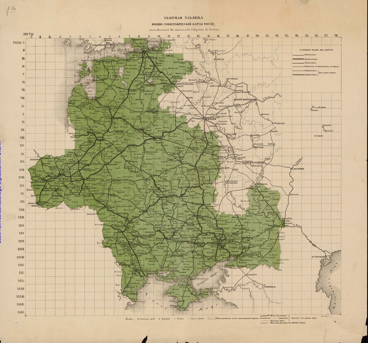
Imagine 4,000 nineteenth-century topographic maps lying in the basement of the James Madison building of the Library of Congress, collecting dust. Imagine that they hold a unique wealth of detail about land use and infrastructure; imagine that together they hold the key to mapping the archive, so to speak, of the late imperial period. But extracting the information they contain is no easy task. The TopoS project is converting the most comprehensive large-scale map series produced during the Russian Empire, the 1:126,000 Military-Topographical Survey of European Russia, into the foundation for pathbreaking research.
Why we are excited (and why you should be)
- The project deploys image processing – AI - technology to facilitate the process of studying thousands of maps.
- The results of our collaboration with the Library of Congress will be accessible to the public.
- The location data we harvest will allow us to map European Russia at a scale and with a level of accuracy that has not been possible before.
A bit of context never hurt!
The Military-Topographic Survey of European Russia was Russian in content but utterly trans-imperial in form. The middle of the nineteenth century was the golden age of topographic mapping, with grand projects conducted by the British, the French, and the Americans. In fact, as the nineteenth century progressed it became clear that the world could be divided into states that could, and states that could not, produce “ideal,” "high-resolution" maps. Topographic surveys could make or break an empire's reputation.
So where does the Russian initiative sit within the global history of state-making through mapmaking?