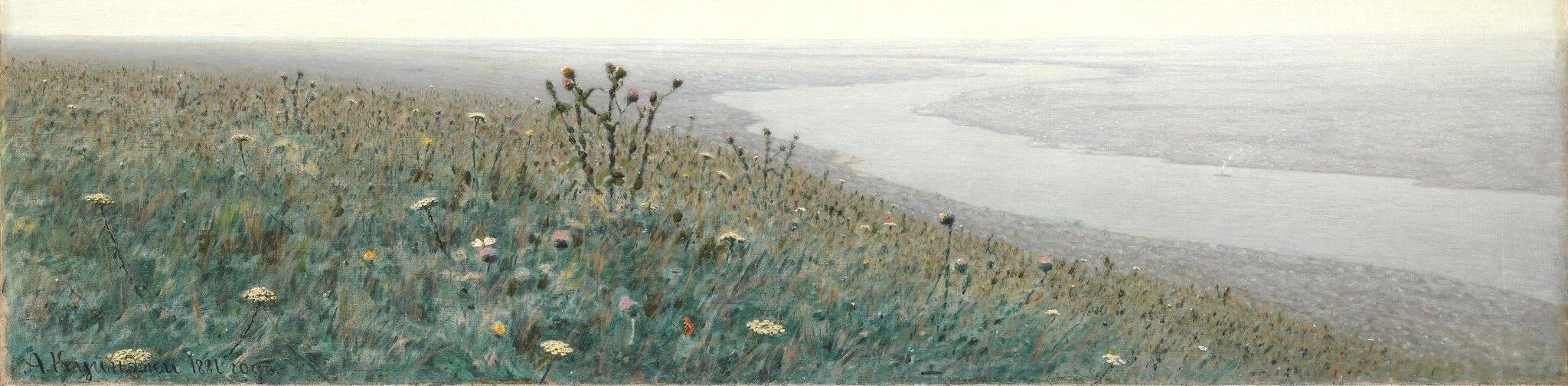
Odes(s)a in Bloom
Names Matter.
The cost of Russia’s war against Ukraine is high, whether calculated in terms of the loss of human life, cultural heritage, or landscape. In the face of all that is being destroyed, this project will help preserve the history of the natural world of Ukraine, starting with some of the most fragile elements of the ecosystem: plants.It might seem like a small thing to know where the sunflowers grew around Odessa in the 1890s, but don't be fooled: it is a powerful thing to be able to talk substantively about changes in biodiversity and the evolution of the built environment over time.
Having that conversation requires forging links between phytonyms (plant names) and toponyms (place names). In the 18th century Carl Linnaeus used the Latin language to classify living things and his practice has persisted through the centuries. The Russian-speaking botanist whose work we study in this project used Latin to identify the plants he observed and we have followed suit, adding the common English names for good measure.
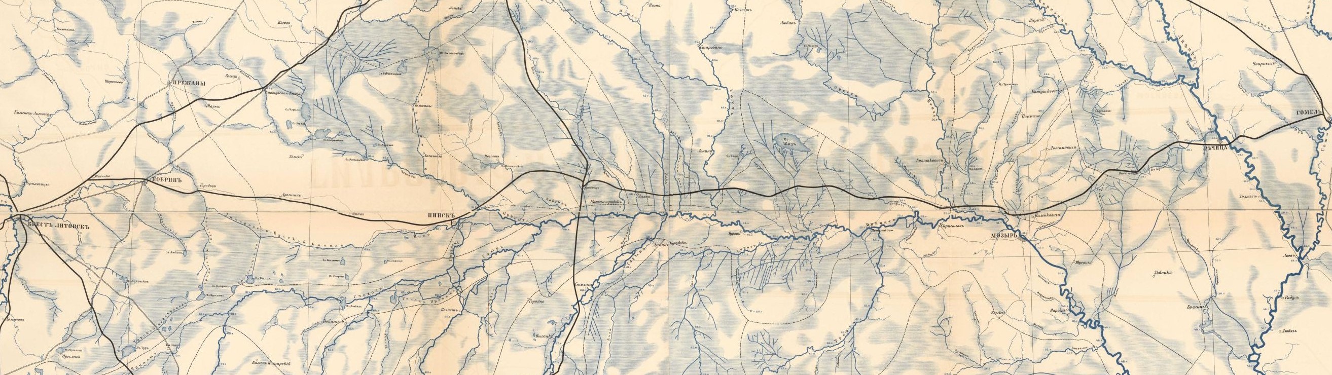
Place names are more complicated. In the 19th century, the tsarist government produced and published most - though certainly not all - documents in Russian. Using a single language to describe and document life in an empire home to more than 130 languages, in which Russians made up roughly 40% of the population, was both practical and political. The challenges of writing about this multiethnic empire were exposed in 1991, when 15 sovereign states, each with a long history of its own, emerged from the territory of the Soviet Union. The relationship between language and territory changed once again. Western audiences might have been familiar with the Russian-language spelling "Kiev" but use of the Ukrainian-language spelling "Kyiv" was mandated by the Ukrainian government in 1995 (and adopted by the UN Conference on Standardization of Geographic Names in 2012). The implications of place names grew even clearer when Russia began its wars against Georgia (2008) and Ukraine (2014).
This is a project about Odesa, a city in Ukraine. It is also a project about Odessa, a city in the Russian Empire in the 1890s.
It is about a place that has been located within the boundaries of the Soviet Union, the Russian Empire, and the Ottoman Empire. When Tatars settled the site, calling it Khadjibey, in the early 15th century, it had already been inhabited for over a millennium. Russian speakers have shaped the development of the city over the past two centuries, but the same is true of speakers of Turkish, Tatar, Ukrainian, Yiddish, Greek, French, Italian, and a great many other languages. When you interact with the maps and visualizations in "Odes(s)a in Bloom" you will notice that we provide the place name given in the primary source, the modern toponym, and a link to the GeoNames entry which provides a list of known alternate names both modern and historical.
And this project involves yet another twist.
Tsarist bureaucrats described their domain - in this case, southern Ukraine - in terms of provinces and districts, rural and urban administrative jurisdictions. They generated lists of provinces and villages, for example, and matching those lists to places in the modern world is an essential, time-consuming, and usually productive piece of historical GIS work.
But not everyone saw the world through the eyes of a bureaucrat. And not everyone used place names to describe locations. Farmers looked out at a landscape of flooded meadows, ploughed fields, and kitchen gardens. Naturalists wrote about hillsides and thickets and coastal cliffs. They and other non-state actors used rich, highly localized spatial vocabularies to describe the world around them.
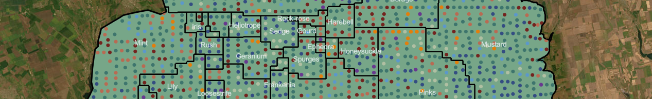
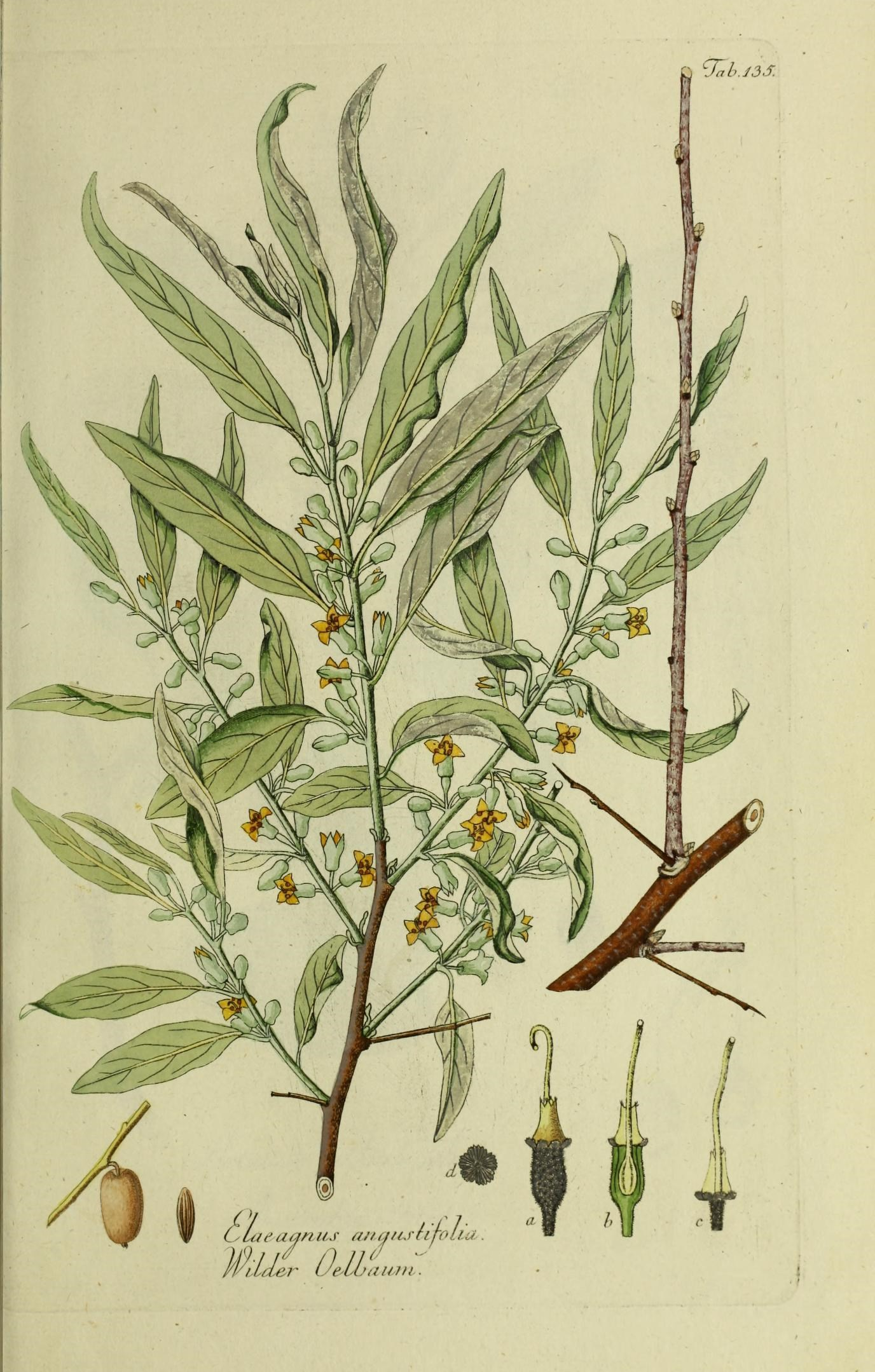
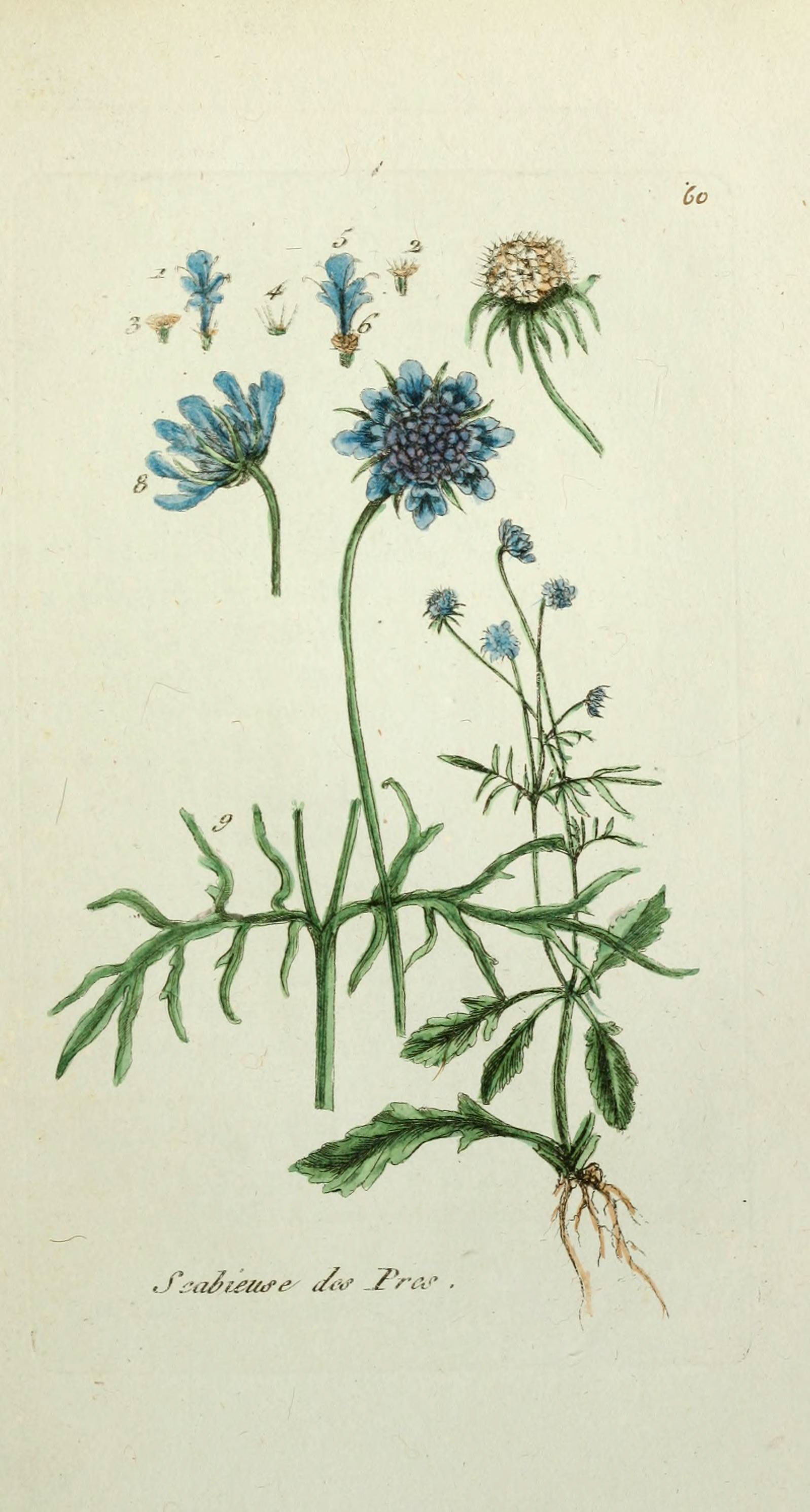
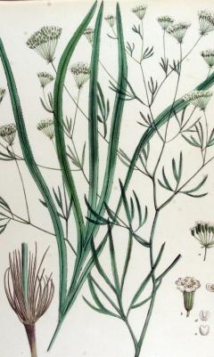
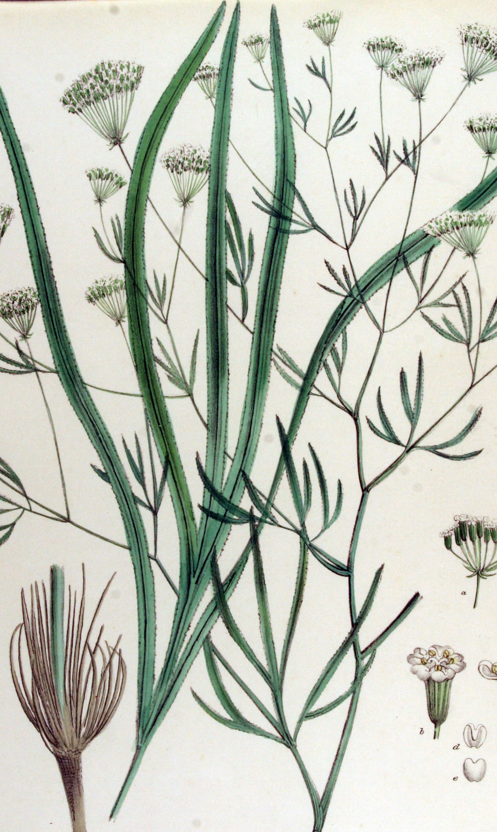
That is the language the botanist P. S. Shesterikov used to describe the location of the longleaf (or sickleweed) plant. It isn’t easy to put such "places" on the map. In fact, it is absurd to think we could ever establish the edges of shrubs that grew 130 years ago. But if we truly want to understand the structure of historical space as it was experienced by everyone, and not only as it was documented by those in power, we must develop new strategies for mapping the past. See the "Mapping Habitats" and "Mapping Odesa" pages to learn about our approach.Falcaria rivini is commonly found in the steppe and along roadsides, and along the edges of shrub areas and coastal bluffs throughout the Odessa region.
The Botanical Data
In the 19th century, botanists combed the land, intent on documenting every plant they could find, from cowbane to chokecherry. We are studying the lists they compiled and building a database that enables us to analyze distribution and prevalence. We are doing this because 1) the history of vegetation and cultivation is important in its own right, 2) plants serve as proxies for other silent actors in the environment, such as soil, insects, and wildlife, and 3) mapping plants is absurdly difficult and therefore fun.We started with a flora (a list of plant observations) published by Pyotr Stepanovich Shesterikov in 1894. Shesterikov (1859-1929) was a botanist and librarian of Novorossiia University, a member of the Imperial Russian Geographical Society, the Kyiv Society of Naturalists, and the Novorossiia Society of Naturalists. He conducted fieldwork 1890-1891 between the banks of the Dnister (Dniester) and Tylihul' (Tiligul’) rivers, describing his work as an effort to reveal the “geobotanical character” of the region.
Shesterikov's list has 950 entries, some of which merely state that previous botanists were wrong about what grew in the Odessa region. Once we pulled those out and eliminated observations of plants growing outside Shesterikov's main field of research we were left with a list of 815 species from 77 families. Shesterikov observed many species in multiple locations, giving a total of 2,813 observations.
The data allows us to ask a range of questions about the distribution and density of plant life. For example:
- How many species of the mustard family grew near Odessa in the 1890s?
- How many sunflower species could be found in local salt marshes?
- Were there any invasive plants?
- Where did the weeds tend to grow?
- Were you to travel back in time to do some hiking along quarries near the Black Sea coast, might you encounter any nightshades?
Together they open a window on the natural world at the end of the 19th century. But remember, as much as there is to "see" here, Odes(s)a in Bloom is built around a single primary source. It draws on only one of the dozens of flora that document botanical biodiversity in southern Ukraine and the Black Sea region. It is nothing more than a (metaphorical) seed. An early bloom.
Dig in!
This project was made possible thanks to funding from the Harvard Data Science Initiative and support from the Davis Center for Russian and Eurasian Studies. The first phase of the project benefitted enormously from a collaboration with the Harvard Map Collection. Read about it here.
Project Team
Kelly O'Neill; Davit Gasparyan; Jackie Erlon-Baurjan; Paul VădanPublication date: 1 April 2024