Relics of Empire
Holy places come in all shapes and sizes.
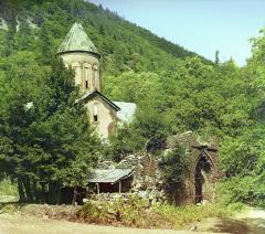
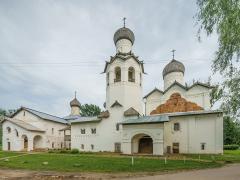
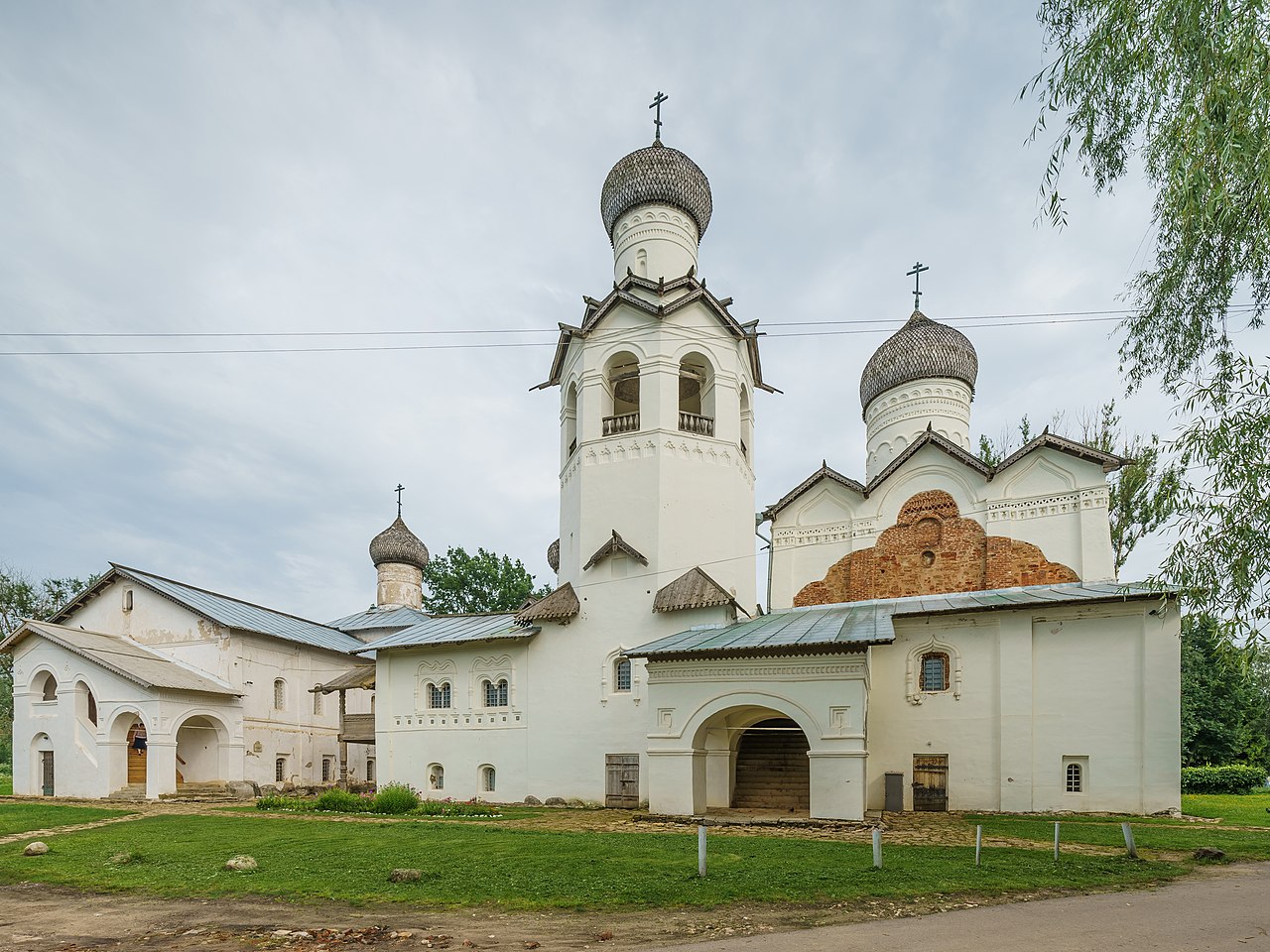
Churches, mosques, and synagogues probably spring to mind, but a holy place could just as easily take the form of a burial site or freshwater spring. As a first step in exploring that full landscape, we decided to look at Orthodox monasteries. There were over 500 monasteries spread across the Russian Empire in the early 19th century. They were sites of pilgrimage and prayer, of course. They were also microcosms of empire complete with hierarchy, privilege and obligation, agriculture, industry, and trade. They were architectural monuments built by tsars and saints, supplied by farmers and traders. Some were a stone's throw from the imperial court, others were located on remote islands in the desolate north. Some were older than the Romanov dynasty.The list we digitized for this dashboard dates to 1817 (more about that below), in the wake of the Napoleonic Wars and in the reign of Alexander I (1801-1825). Although a few were abolished or destroyed before or during the reign of Alexander, most survived to the end of the imperial period. After 1917 they were abandoned, repurposed, or destroyed by the secularization campaigns of the Communist regime, but many have been restored as working monasteries or protected historical sites. They are located in the Russian Federation but also Ukraine, Belarus, Poland, Latvia, Lithuania, and Moldova. All of which is to say that the stories of these holy places extend well beyond the boundaries of the maps we have produced. We hope you will reconstruct them. And if you do, we want to hear them!
The Monasteries Map
Get the Most Out of the Map
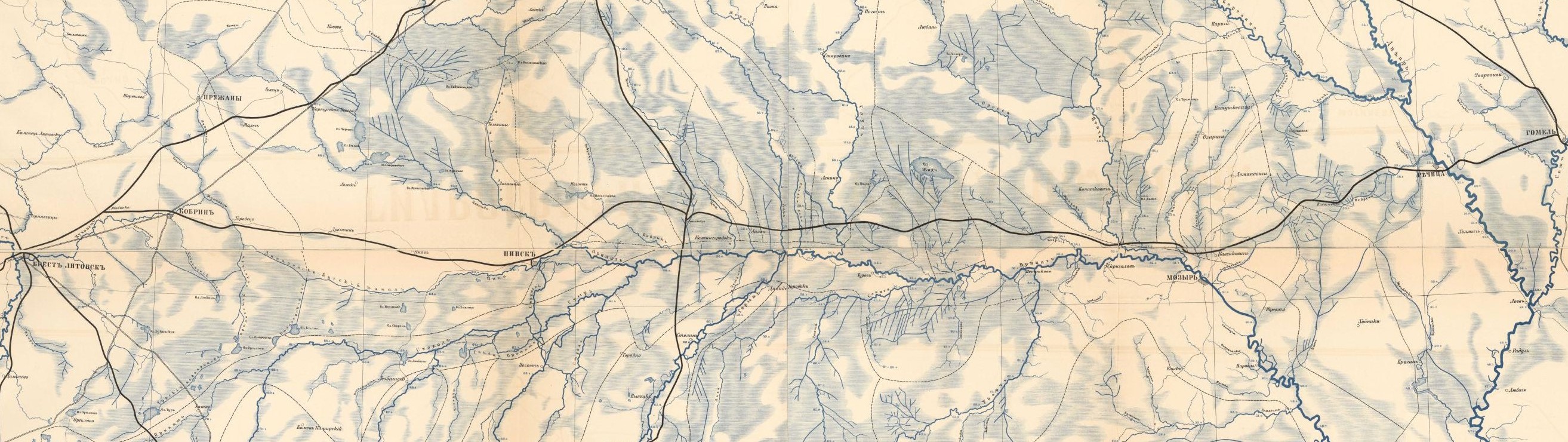
Starting Point: The initial view shows the location of 485 monasteries (we were unable to locate 27 with any degree of confidence), with a distinction between monasteries and hermitages. Click on any point to learn about the site. Zoom, pan, and use the search tool. Try toggling on the "aggregations" layer: the darker the color, the more monasteries are located in that area. This tool can be useful as in many cases monasteries are located very close to one another and it is difficult to notice the overlap.Add Layers: The layer button (upper left of the display) will allow you to control the amount of data you are navigating. Play with selecting monasteries with relics (therefore more likely sites of pilgrimage or enhanced liturgical significance) or those located more than 100 kilometers from the nearest provincial capital. Compare relative distance with the number of churches built on a given site: are there correlations?
Spatial Analysis 101: Use the measure tool (upper left of the display) to assess distance or area. Or try the near tool. A drop-down box allows you to target your search for a lake, river, or town. You can then identify the monasteries located up to 50km from that feature. Note that most rivers are divided up into multiple line segments - try a few to find the one you want to work with.
Note for the careful observer: Some of the layers are marked "GARE system." This means their data was extracted from the Geographical Atlas of the Russian Empire, published in the 1820s. We compiled a mosaic from the individual sheets of the atlas and georeferenced it, which enabled us to work with the atlas as a continuous spatial system. The locations do not match up precisely with modern GIS data, so you will notice a minor discrepancy between basemap data and the GARE version of provincial towns, the post roads, or provincial boundaries. Don't let the "inaccuracy" bother you: focus on the patterns they reveal and the questions they raise about variations across imperial space.
We Know What You Are Thinking.
"If only there were a fun scavenger hunt." OH WAIT, THERE IS A FUN SCAVENGER HUNT!
"If only the data were accessible (and free)." SOME WISHES COME TRUE.
"If only someone would explain why this map matters."
The Map, the Source, and Why it all Matters
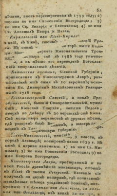
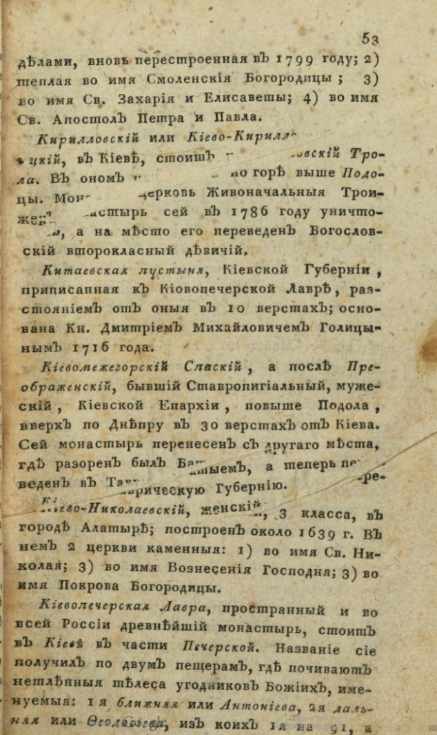
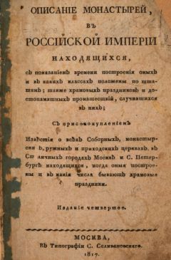
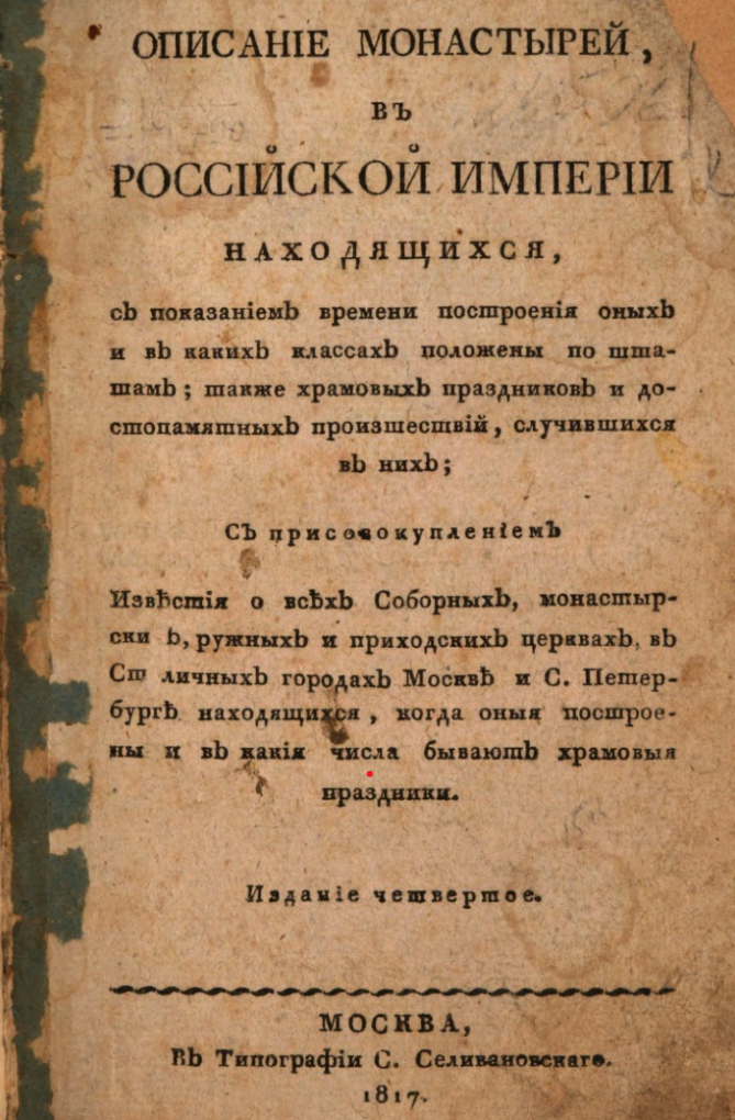
The source for this dashboard is a single volume published in 1817. It is called A Description of the Monasteries of the Russian Empire with dates of establishment and class designation, church holidays and commemorations, and an appended list of all cathedral, monastic, and parish churches in the cities of Moscow and Saint Petersburg, with their dates of construction and associated holidays. That is quite a mouthful. And it is quite a source. Here are 4 things you should know about it.1. It flew off the shelves.
The 1817 volume was the 4th edition, and by 1834 the 8th edition had appeared: there was a massive appetite for information about Orthodox sites in 19th century Russia.
2. It is not perfectly accurate.
Why? For one thing, it claims to cover the whole territory of the empire and in fact includes monasteries in modern day Belarus, Latvia, Lithuania, Poland, Ukraine, Moldova, and Russia as far east as Kamchatka. But the boundaries of the empire were constantly changing. In the late 18th century and early 19th century Catherine II and her successors conquered and annexed large portions of the Polish-Lithuanian Commonwealth, the Cossack Hetmanate, the Crimean Khanate, Bessarabia, and Finland. They acquired portions of other Ottoman lands, as well as kingdoms and khanates of the Caucasus. Acquiring territory often meant acquiring monasteries.
Even if the geography of the empire hadn't been in flux, the landscape of monasteries was always changing. While monasteries were generally stable fixtures (most had at least one stone church), fire, plague, war, politics, patronage practices, commercial networks, and a host of other factors could lead to the establishment of a new site or the demise of an existing one. News of such changes flowed unevenly from village to capital: it took a lot of effort (and luck) to compile a mountain of knowledge like the Description.
3. It sheds light on cultural life in the Russian Empire.
It was published by Pyotr Ioannikievich Selivanovsky, one of the most famous typographers and book publishers of the 19th century. Selivanovsky established himself during the reign of Catherine II, who not only tolerated but even encouraged book publishing... until she didn't. In 1796 Catherine shut down private presses, but by that time Selivanovsky had already published more than 60 volumes. The admiral of the Black Sea Fleet invited Selivanovsky to Mykolaiv (Nikolaev), where he worked for several years until moving to Moscow. There he ran the Senate press and opened his own press in 1802. He published broadsides during the Napoleonic invasion, works by luminaries such as Lomonosov and Rousseau, as well as almanacs, journals, and... monastery lists.
4. It connects the Russian Empire to international developments in science.
The Description is a typical object of its time. It is a gazetteer: a list of places with location information, organized alphabetically. The genre was all the rage in Europe and North America, a product of the Enlightenment project of collecting and systematizing information about the known world. Though a few brave souls attempted to compile universal geographical dictionaries, most early gazetteers focused on a single region or topic, such as archaeological sites, market towns, rivers, gardens, mines... or monasteries.
Read about (and access) the data here!
Project Team
Jordan Bryant, Sonya Gupta, Olga Kiyan, Kelly O'Neill, Paul VădanCite the Dashboard
O'Neill, Kelly. "Relics of Empire: The Geography of Holy Places." The Imperiia Project: A Spatial History of the Russian Empire. April 25, 2024. https://imperiia.scalar.fas.harvard.edu/imperiia/relics [date of access].This work is licensed under CC BY-NC-SA 4.0![]()
![]()
![]()
![]()