The Imperiia ProjectMain MenuResearch Dashboardsmaps, visualizations, and moreVeles: The Data CatalogOngoing ProjectsThe MapMaker PodcastEvery story starts somewhere.Teach with MapsGalleriesKelly O'Neilldc20b45f1d74122ba0d654d19961d826c5a557f5The Imperiia Project // Davis Center for Russian and Eurasian Studies, Harvard University
Maps of Sevastopol
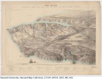
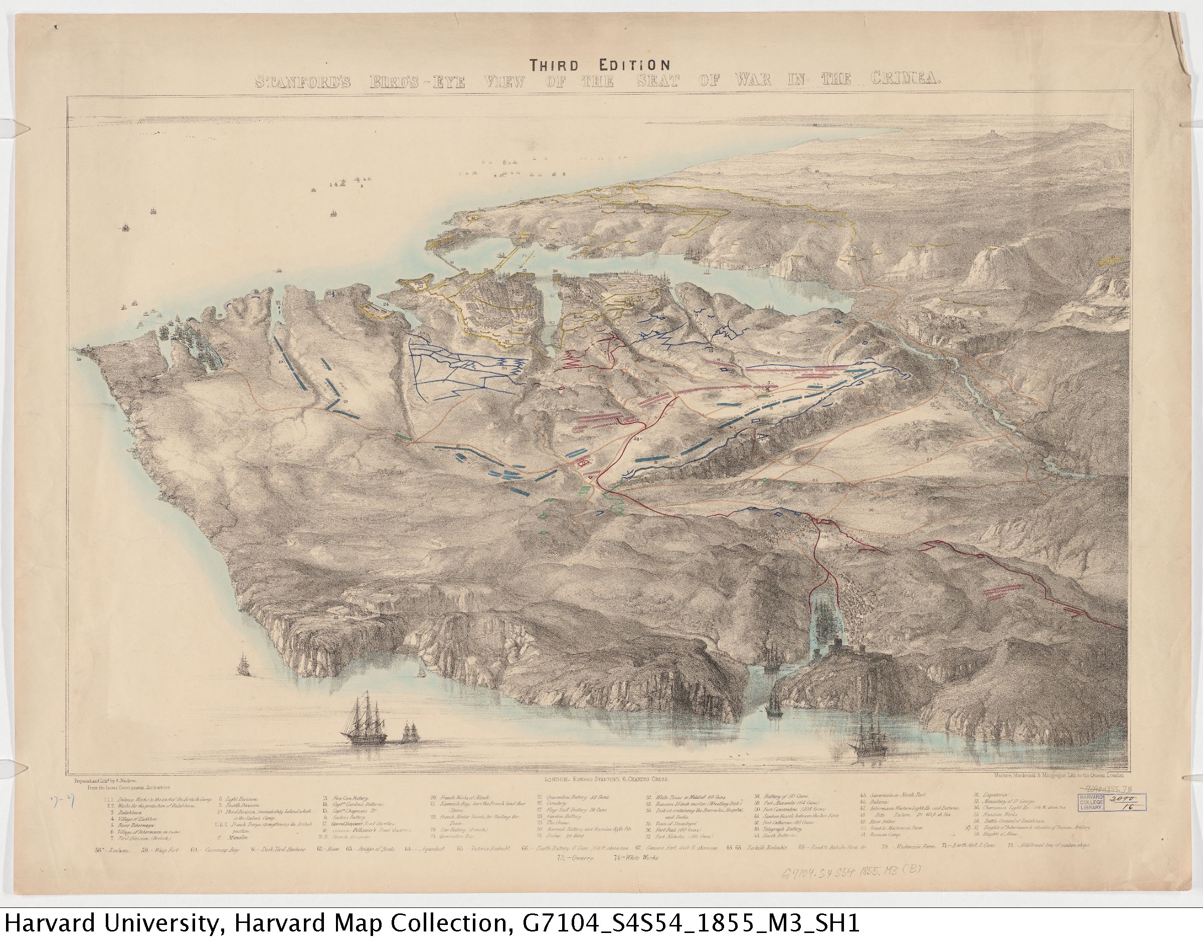
12018-03-07T16:02:06-05:00Drake Marshalld994c3f83455130c658bc3fb040555c7c8b570cc91plain2018-03-23T04:47:44-04:00Drake Marshalld994c3f83455130c658bc3fb040555c7c8b570cc1855 Map of "The Seat of War in the Crimea," showing the topography of the area as well as troop positions and lines of entrenchment
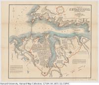
1855 Map of Sevastopol showing the Great Bay and the harbors, as well as fortifications and siege-works
This page has paths:
12018-03-07T10:43:58-05:00Drake Marshalld994c3f83455130c658bc3fb040555c7c8b570ccWelcome to SevastopolDrake Marshall1plain2018-03-23T05:18:09-04:00Drake Marshalld994c3f83455130c658bc3fb040555c7c8b570cc