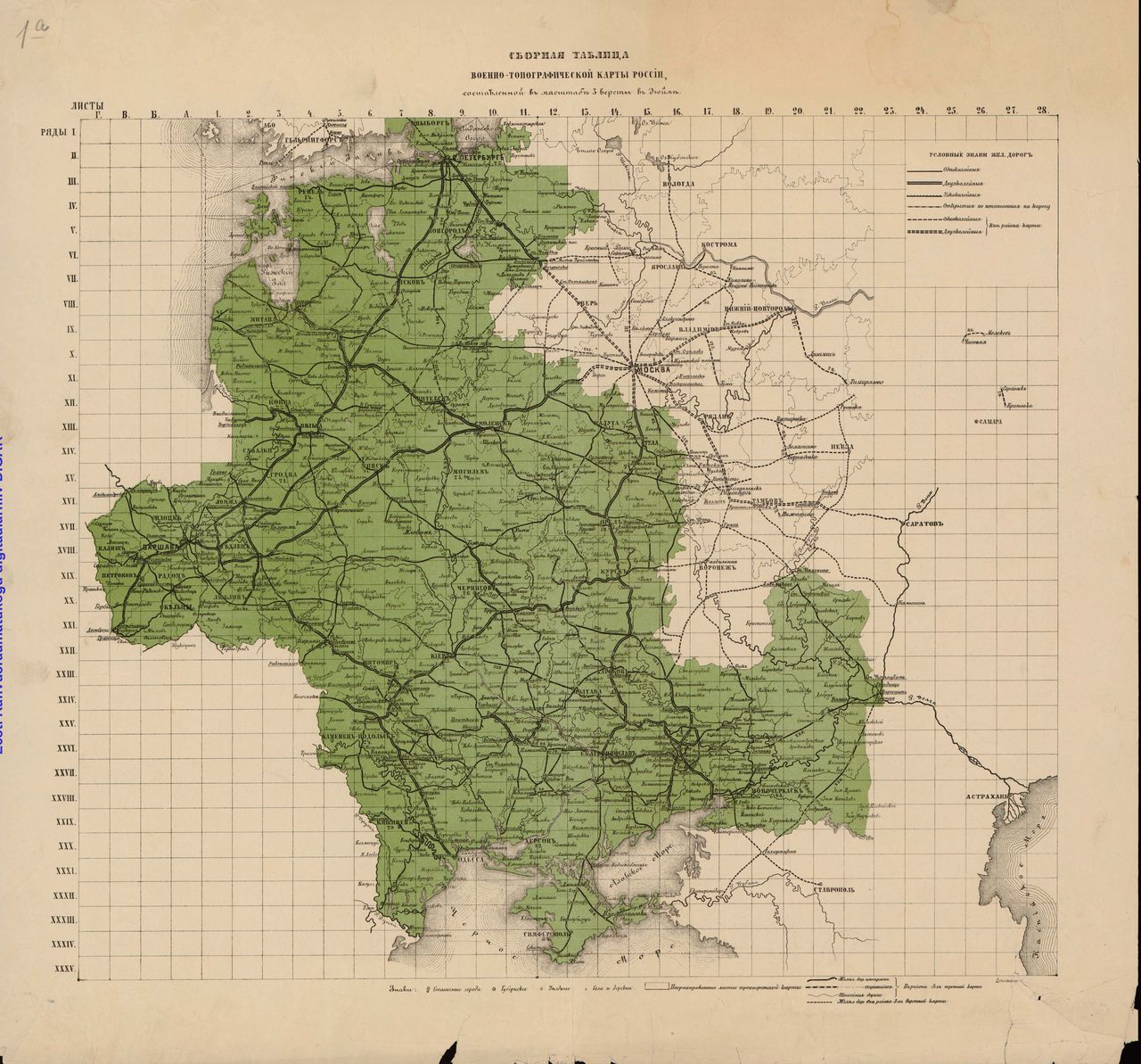
Description of an individual sheet
- sheet title (top, center)
- row number (top, left)
- column number (top, right)
- Name of engraver or engravers (bottom, left)
- Scale (bottom, center)
- Text editor (bottom, right)
- Note referencing previous iterations and/or corrections (bottom, right)
- Legend (rare, found on maps printed in Warsaw)
- Stamps of libraries, archives, or individual collectors
- Library of Congress Map Collection stamp showing acquisition date
- Library of Congress Map Collection stamp showing call number
- Handwritten annotations (in Russian and English)
Between the neatline and the mapped area there are two sets of coordinate locators. These are lines composed of regular segments. The segments alternate gray and white. Each represents one minute of latitude or longitude, respectively.
The mapped area shows gridlines at every 20 minutes (of longitude and latitude).
Each sheet depicts an area roughly 69 versts (46 miles) wide by 50 versts (33 miles), or 1,518 square miles - just shy of one million acres or almost exactly the size of Rhode Island.