Semyon Aleksandrovich Mukhin
Born: 1772 in Kremenchug
Died: 1828
Occupation: surveyor, cartographer, officer
Backstory
Mukhin studied at home, and then at the Azov Province Survey Expedition. One of his first military posts was as a surveyor in Tavrida province (with the rank of ensign), from 1784 to 1788. He participated in the storming of Anapa, and in the suppression of the "confederates" in Poland in the early 1790s. He later served in the Mariupol Hussars regiment, and in 1797 was sent to conduct topographical surveys of Crimea and the Black Sea provinces. In the next decade Mukhin conducted surveys in Poland, St. Petersburg, and Volynia, acquiring the rank of major-general in 1805, and setting to work on a general map of the empire in 1810.
Talented but with a flawed work ethic, Mukhin was demoted from the heights of quartermaster-general (in the Suite of His Imperial Majesty) to the post of assistant to the chief of the Cartography Depot in 1812.
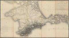
Why He Matters
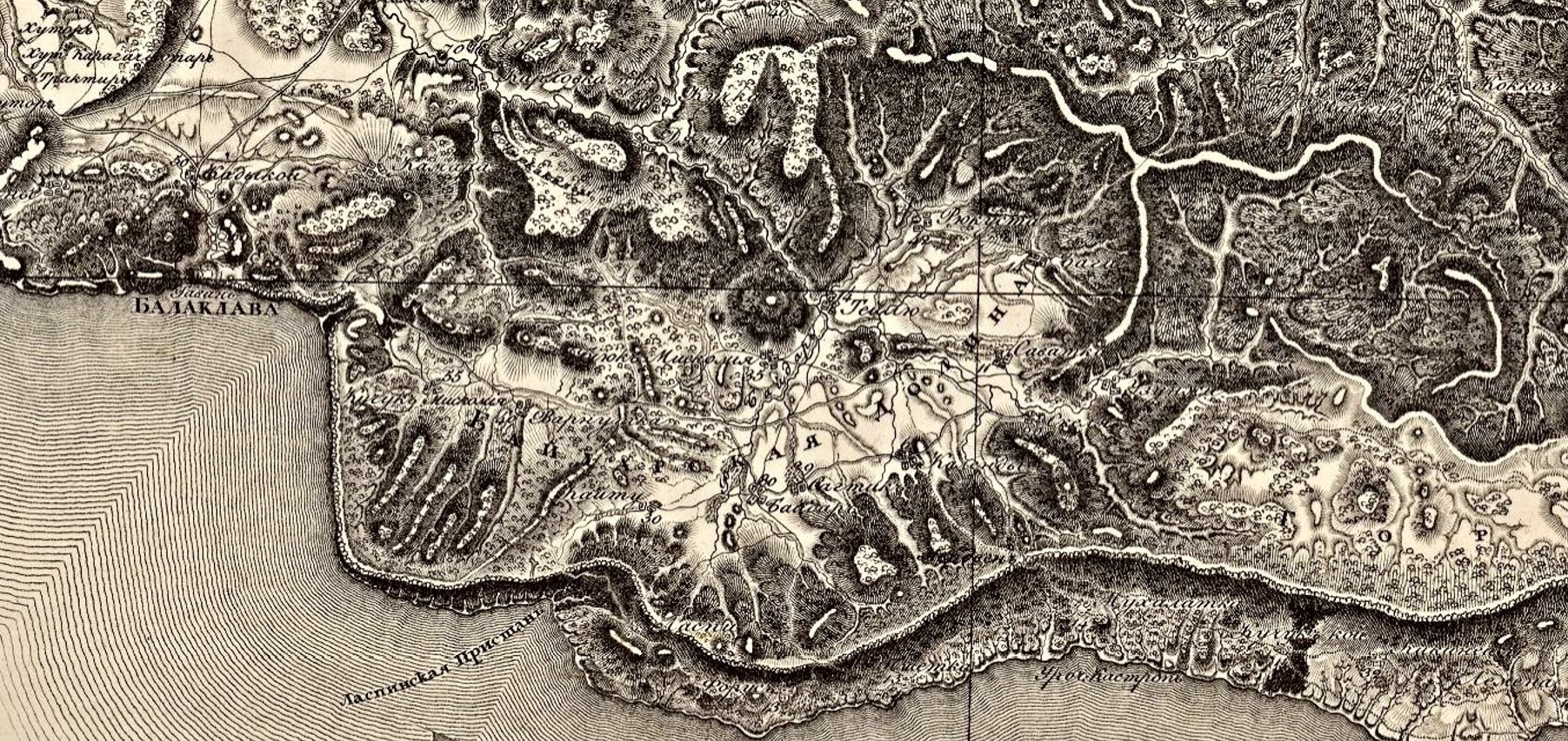
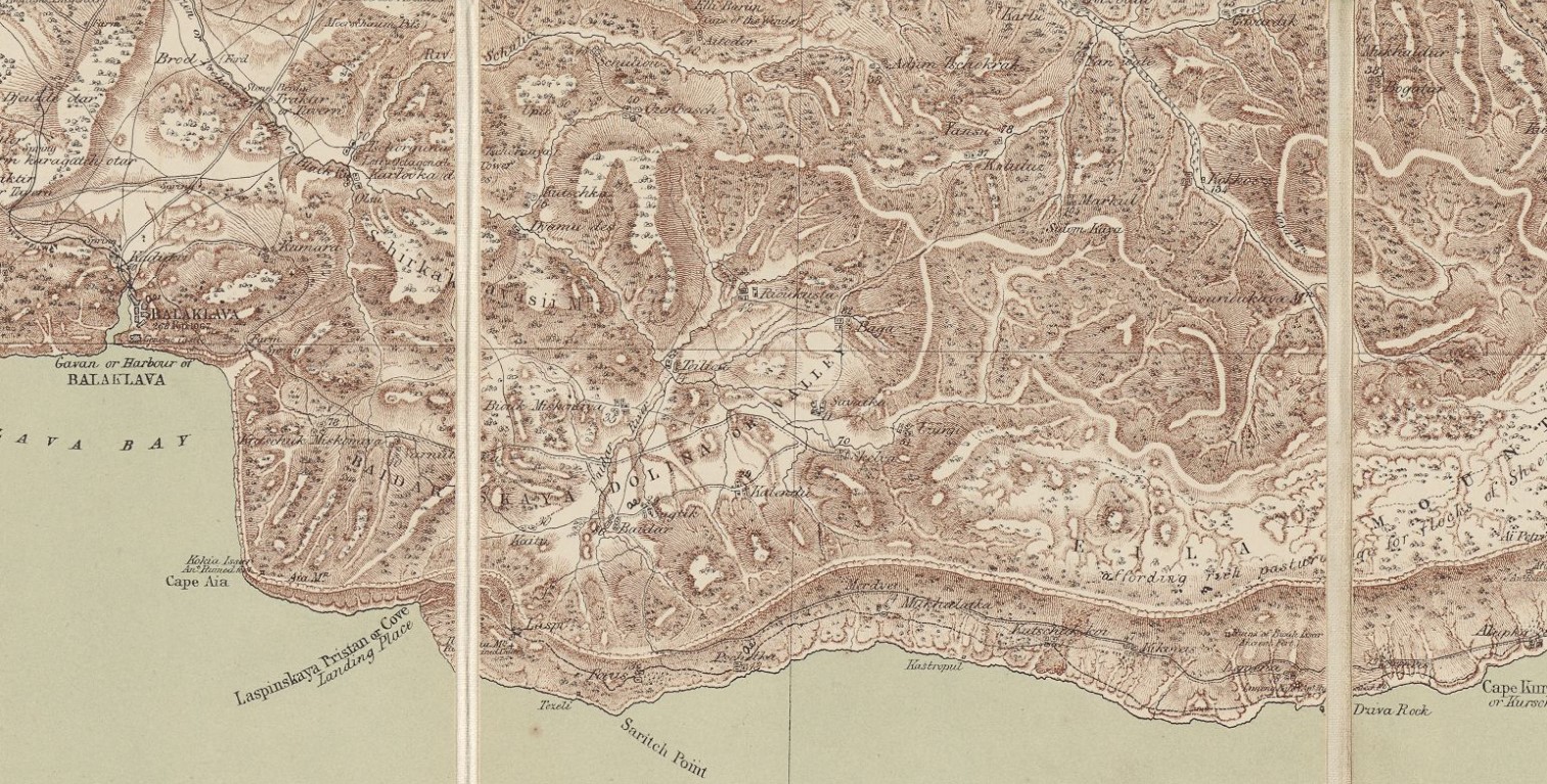
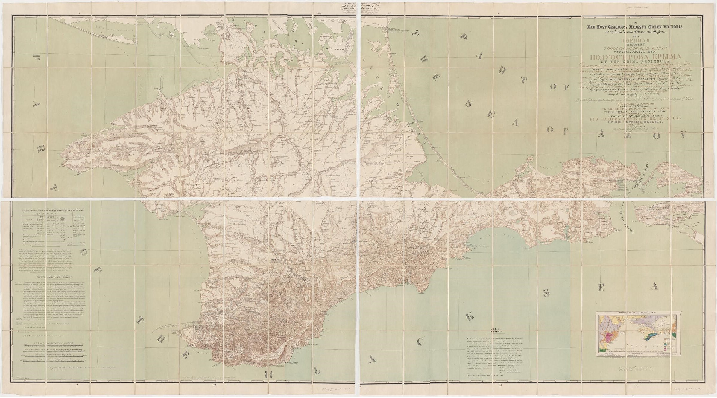
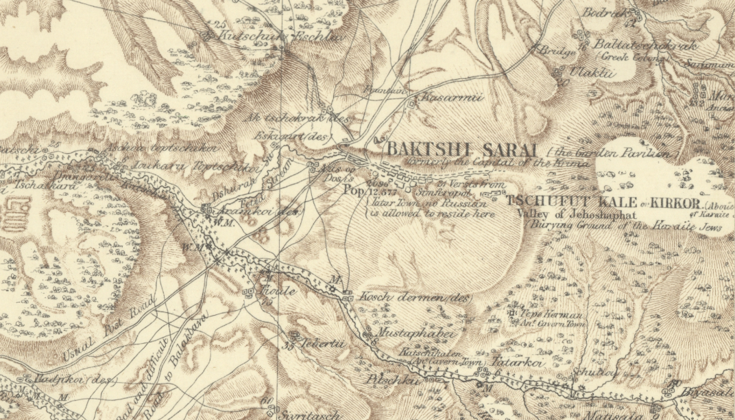
Mukhin's far-and-away most important professional achievement was to convert the survey work he conducted at the turn of the 19th century into a topographical map of Crimea. Two decades passed between the production of the data and the production of the map, but no matter. Mukhin received the commission in 1815 and delivered the map the following year. In return for his efforts, he was awarded 6,000 rubles - a rather enormous sum of money, and his renowned map was engraved and published in 1817. Contemporary experts considered his map of Crimea the exemplary work of Russian cartography until the 1880s.