Topographical map of Crimea, 1817
1 2022-07-03T08:56:15-04:00 Kelly O'Neill dc20b45f1d74122ba0d654d19961d826c5a557f5 9 1 Full title: Military-topographical map of the Crimean peninsula based on the latest astronomical observations, corrected and enhanced with the best military surveys, by Major-General Mukhin of the Quartermaster Section of His Imperial Majesty's retinue on the orders of General and Adjutant Prince Volkonskij during his command of the region. plain 2022-07-03T08:56:15-04:00 1817 Семён Мухин, Военная-топографическая карта полуострова Крыма (СПб, 1817) Kelly O'Neill dc20b45f1d74122ba0d654d19961d826c5a557f5This page is referenced by:
-
1
2022-06-27T12:39:21-04:00
Orchard Locator
37
Gardens of Crimea component
plain
2023-01-10T00:01:32-05:00
Ready to turn the clock back to the early nineteenth century?
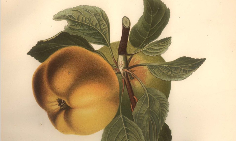
"Gardens of Crimea" highlights the 809 orchards registered as state properties in the early years of Russian imperial rule. The registers associate each orchard plot with one of eighty-nine villages, but for thirty we have data identifying tree quantities and types. Those thirty villages are highlighted in this project.
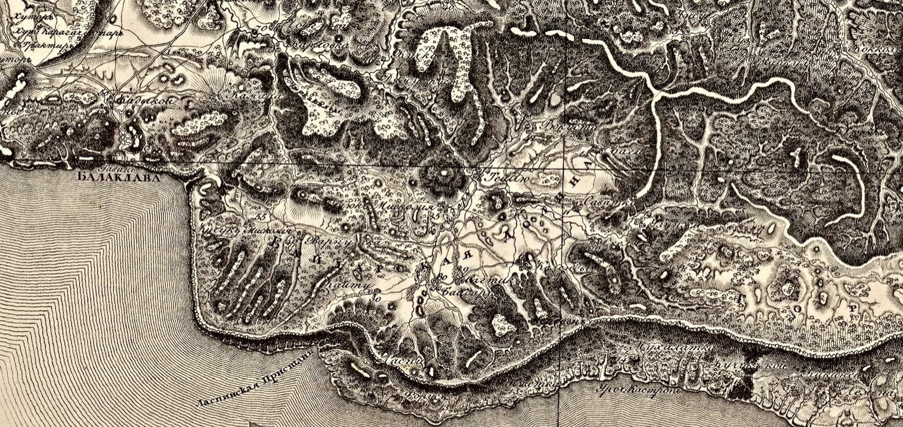
In 1817 a cartographer named Semyon Mukhin working for the Military Topographical Depot of the Russian General Staff produced a ground-breaking topographical survey map of Crimea.
Mukhin published his map twenty-four years after the compilation of the garden registers - that is a meaningful amount of time in which all sorts of things changed. Wars, droughts, earthquakes, tragedies and triumphs of all kinds. Nevertheless, this is the first map produced at a scale that allows us a detailed look at the peninsula's topography. It allows us to see each village in its historical context. For example, here is the famous Baydar Valley..
The southern coast of Crimea runs along the bottom of the map detail. Balaklava is shown on the coast near the western edge. The Crimean mountains are depicted as a ridge line running west to east along the bottom. Areas rendered dark by hachures (lines representing elevation change) are set off from bright areas, some of which are at higher altitude (such as the alpine plateau at lower right) and some of which are low, such as the Baydar Valley at the center. The map describes the valley as partially forested, crossed by streams, and with a road running through the center.
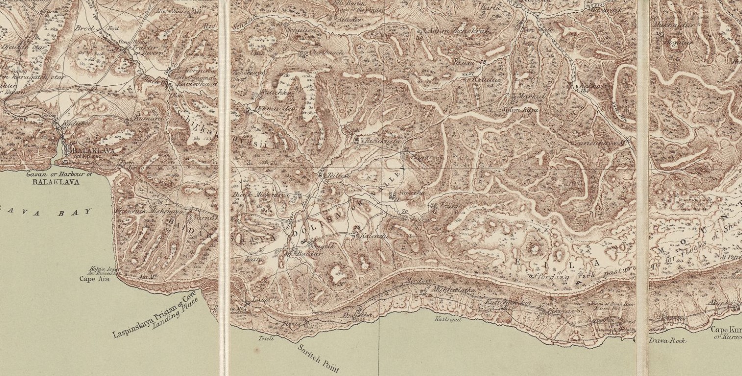
Now for a bit of magic. What if you could see the same map, rendered in English instead of Russian?
This is Thomas Best Jervis' 1855 edition of the same map. (How Mukhin's high-end military-topographical survey of Crimea ended up in British hands on the eve of the Crimean War is a story for another day.) You can see that the cartography and data are more or less unchanged. The 1855 English edition still claims, for example, that there were 80 households in the village of Baydar.
Let's use this later edition to orient ourselves to the space described in the registers. Move your cursor across the image to see the orchard locations. The villages are listed below as "tagged" pages - go to any location page by clicking the placename.Curious about the broader geography of fruit cultivation? Check out this interactive map!
-
1
2018-11-21T00:17:49-05:00
Semyon Aleksandrovich Mukhin
11
surveyor, cartographer, officer
plain
2022-07-12T13:03:42-04:00
1772 - 1828
Семён Александрович Мухин
Born: 1772 in Kremenchug
Died: 1828
Occupation: surveyor, cartographer, officer
Backstory
Mukhin studied at home, and then at the Azov Province Survey Expedition. One of his first military posts was as a surveyor in Tavrida province (with the rank of ensign), from 1784 to 1788. He participated in the storming of Anapa, and in the suppression of the "confederates" in Poland in the early 1790s. He later served in the Mariupol Hussars regiment, and in 1797 was sent to conduct topographical surveys of Crimea and the Black Sea provinces. In the next decade Mukhin conducted surveys in Poland, St. Petersburg, and Volynia, acquiring the rank of major-general in 1805, and setting to work on a general map of the empire in 1810.
Talented but with a flawed work ethic, Mukhin was demoted from the heights of quartermaster-general (in the Suite of His Imperial Majesty) to the post of assistant to the chief of the Cartography Depot in 1812.
Why He Matters
Mukhin's far-and-away most important professional achievement was to convert the survey work he conducted at the turn of the 19th century into a topographical map of Crimea. Two decades passed between the production of the data and the production of the map, but no matter. Mukhin received the commission in 1815 and delivered the map the following year. In return for his efforts, he was awarded 6,000 rubles - a rather enormous sum of money, and his renowned map was engraved and published in 1817. Contemporary experts considered his map of Crimea the exemplary work of Russian cartography until the 1880s.