The Imperiia ProjectMain MenuResearch Dashboardsmaps, visualizations, and moreVeles: The Data CatalogOngoing ProjectsThe MapMaker PodcastEvery story starts somewhere.Teach with MapsGalleriesKelly O'Neilldc20b45f1d74122ba0d654d19961d826c5a557f5The Imperiia Project // Davis Center for Russian and Eurasian Studies, Harvard University
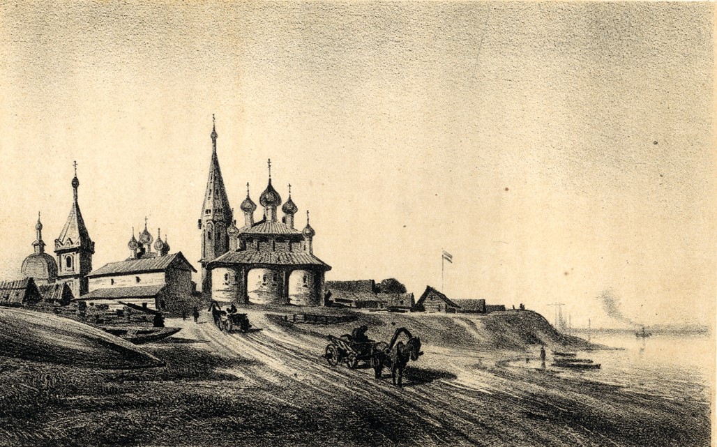
view of Cheboksary circa 1862
12021-02-23T12:32:27-05:00Kelly O'Neilldc20b45f1d74122ba0d654d19961d826c5a557f591illustration from The Volga from Tver to Astrakhan (Published by Samolet Company, 1862)plain2021-02-23T12:32:27-05:00Kelly O'Neilldc20b45f1d74122ba0d654d19961d826c5a557f5
This page is referenced by:
12021-03-01T10:34:02-05:00I wondered how she knew these things4plain2021-03-01T11:26:10-05:00... but then I noticed the weathered guidebook lodged between her elbow and the ship's rail. She had been reading a guide published in 1862. And not just any guide. It was the first-of-its-kind guidebook to Russian river travel. And it was published by the Samolet Steam Company - the very company operating the ship on which we are sailing.
The Volga, from Tver to Astrakhan is a pretty thing. It is graced with dozens of lithograph illustrations and sketches by one of the finest artists of the day, Aleksey Petrovich Bogolyubov, who just happened to be sailing the Volga for another purpose entirely, having been commissioned by the Naval Ministry to collaborate on a hydrographical atlas of the Caspian Sea. When they found out, Samolet asked Bogolyubov to document the towns and landscapes along the route (in such a way that they appeared picturesque, I imagine).
Which he did. And that is how I came across this picture of Tscheboksari as it was half a century ago, in 1862.