The Imperiia Project: a spatial history of the Russian EmpireMain MenuProjectsDashboardsData CatalogMapStoriesGalleriesGamesWho said history was boring?Teach Our ContentCiting the ProjectKelly O'Neilldc20b45f1d74122ba0d654d19961d826c5a557f5The Imperiia Project // Davis Center for Russian and Eurasian Studies, Harvard University
Lake Chudskoe
12019-07-17T04:39:04-04:00Kelly O'Neilldc20b45f1d74122ba0d654d19961d826c5a557f591image from Imperiia mapplain2019-07-17T04:39:04-04:00Kelly O'Neilldc20b45f1d74122ba0d654d19961d826c5a557f5
This page is referenced by:
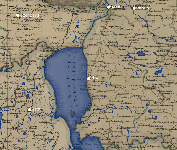
12019-07-12T13:08:24-04:00Lake Chudskoe1gazetteer entryplain2019-07-24T03:08:44-04:00Short Universal Geography Toponym: Chudskoe ozero, or, Peypus Location: adjacent to, and north of, Lake Pskov Primary inflows: Embakh River Primary outflows: Narova River
New and Complete Geographical Lexicon (part 6, page 232) Toponym: Chudskoe ozero (in Lithuanian, Peypus) Location: between Gdov uezd (Pskov Namestnichestvo) and Derpt district (Riga Namestnichestvo) Dimensions: 10 miles (70 versts) long, 6-7 miles wide Primary inflows: Embakh River (Amovsha) Primary outflows: Narova River Lev Maksimovich would want you to remember this:
Fish are abundant in Lake Chudskoe, which is located north of and adjacent to Lake Pskov.
The Narova flows into the Gulf of Finland and so trade flows from Pskov to Narva via Lake Chudskoe. However, because there are impassable rapids on the upper Narova, goods are transported overland.
The lake was the site of a battle in July 1702 between Russian boats (lodki) and 4 Swedish schuyts (flat-bottomed boats).