The Imperiia ProjectMain MenuResearch Dashboardsmaps, visualizations, and moreVeles: The Data CatalogOngoing ProjectsThe MapMaker PodcastEvery story starts somewhere.Teach with MapsGalleriesKelly O'Neilldc20b45f1d74122ba0d654d19961d826c5a557f5The Imperiia Project // Davis Center for Russian and Eurasian Studies, Harvard University
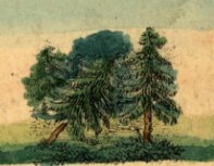
forests in Plotsk
12020-08-26T23:29:33-04:00Kelly O'Neilldc20b45f1d74122ba0d654d19961d826c5a557f591detail of geographic playing cardplain2020-08-26T23:29:33-04:00Kelly O'Neilldc20b45f1d74122ba0d654d19961d826c5a557f5
This page is referenced by:
12020-08-17T01:43:43-04:00forests24playing card taggoogle_maps2022-05-18T03:39:25-04:00What does the map above tell you?
The cards speak not of forests, but of "bountiful forests."
Starter Question:
Chukotka/Kamchatka and the lands of the Black Sea Cossack Host are some 4,000 miles apart. But they share two common geographical features: forests (of course) and... can you figure out the other?