The Imperiia ProjectMain MenuResearch Dashboardsmaps, visualizations, and moreVeles: The Data CatalogOngoing ProjectsThe MapMaker PodcastEvery story starts somewhere.Teach with MapsGalleriesKelly O'Neilldc20b45f1d74122ba0d654d19961d826c5a557f5The Imperiia Project // Davis Center for Russian and Eurasian Studies, Harvard University
All as it should be
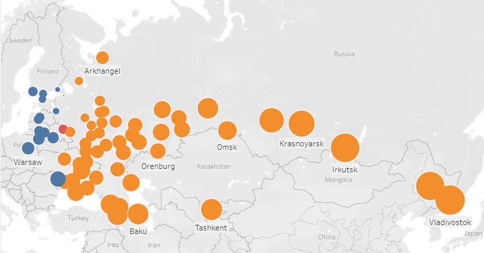
12020-10-26T12:07:41-04:00Kelly O'Neilldc20b45f1d74122ba0d654d19961d826c5a557f591visualization of the distance, in time and space, of locations from St. Petersburg in 1914 (data from the Baedeker Handbook)plain2020-10-26T12:07:41-04:00Kelly O'Neilldc20b45f1d74122ba0d654d19961d826c5a557f5
This page is referenced by:
12020-10-26T12:03:16-04:00Mapped.5plain2021-01-21T19:33:18-05:002020-10-02T13:30Look at it this way, if you like. The bigger the dot, the bigger the time difference.
Actually, play with the data yourself. Because it is easier to see when you can touch. (Or do the digital equivalent of touching.)
There is only one place in the empire where spatial distance and temporal distance... how shall we put it... correspond poorly.