Fields on Fire
What It Is
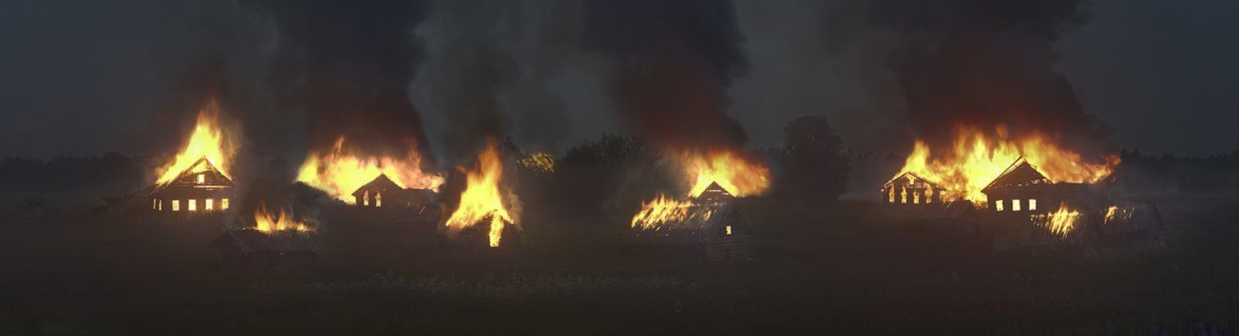
The Fields on Fire dataset describes the frequency and impact (in terms of the quantity and cost of burned households) of 66,112 fires in 49 European provinces of the Russian Empire from 1860 through 1864. A subset of the data addresses incidents of arson. The data was sourced from an official publication by the Ministry of Internal Affairs and mapped according to historical spatial data extracted from the Geographical Atlas of European Russia (with boundaries adapted to reflect the 1860s). The package includes province-level data (polygons) and town-level data (points).
GET THE DATA
Explore the maps
About the Primary Source
Статистическия сведения о пожарах в России [Statistical Information about Fires in Russia] was published in Saint Petersburg in 1865 by the Central Statistical Committee of the Ministry of Internal Affairs of the Russian Empire. Working under the direction of I. Vil'son, imperial statisticians compiled data from bi-monthly and annual reports on "events" submitted by provincial governors. The reports were supposed to document the date and location of every fire, along with cause and cost of losses. However, the introductory notes point out that cause and cost often went unrecorded and that disputes among officials about fundamental ideas such as what constituted a building, led to inconsistencies and discrepancies in the reports. Some included storage sheds or warehouses or wine cellars, while others did not consider such objects as "losses." Some officials documented partially burned buildings, while others documented only those that constituted a total loss. In the 1865 publication, arson is the only cause of fire identified explicitly in the statistical tables, though others are discussed in the introduction.
Historical Context
The 1860s were a volatile time in the Russian Empire. In the wake of a catastrophic loss in the Crimean War and subsequent signing of the Treaty of Paris (1856), Tsar Alexander II and his government were forced to reckon with an array of forces threatening to pull apart the foundation of imperial society. The emancipation of the serfs (1861) was an event of world significance and certainly the single most important result of the great reckoning. But it was no panacea and marked the beginning of a decade of reform and reaction. Peasant unrest was rife, though it rose and fell, until the very last days of the empire. The regime associated fire, particularly arson, very closely with peasant unrest and kept close tabs on each event, taking advantage of the rise of statistical surveying and the bureaucratic expansion underway since the 1840s. The agency that compiled and published this data, the Central Statistical Committee of the Ministry of Internal Affairs, was established in 1852. It collected data at the provincial, district, and town level.
Project Team
Davit Gasparyan; Thomas Schaffner; Kelly O'Neill, Paul Vădan
Publication Date
February 29, 2024