Urban Space on the Edge of Revolution
We are building a platform for studying the urban fabric of towns in the late imperial period.
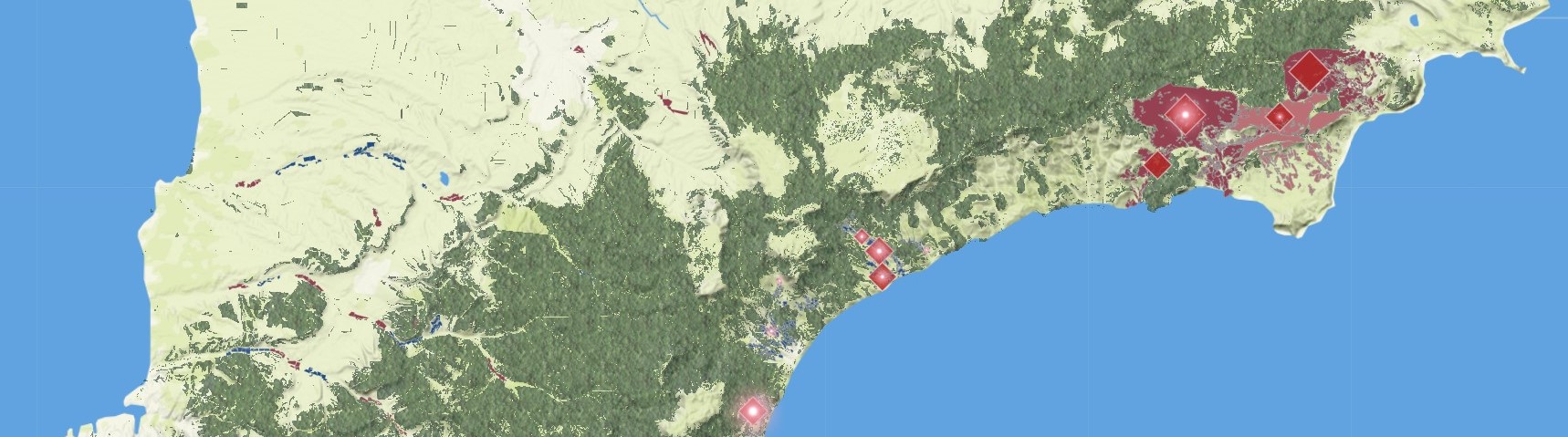
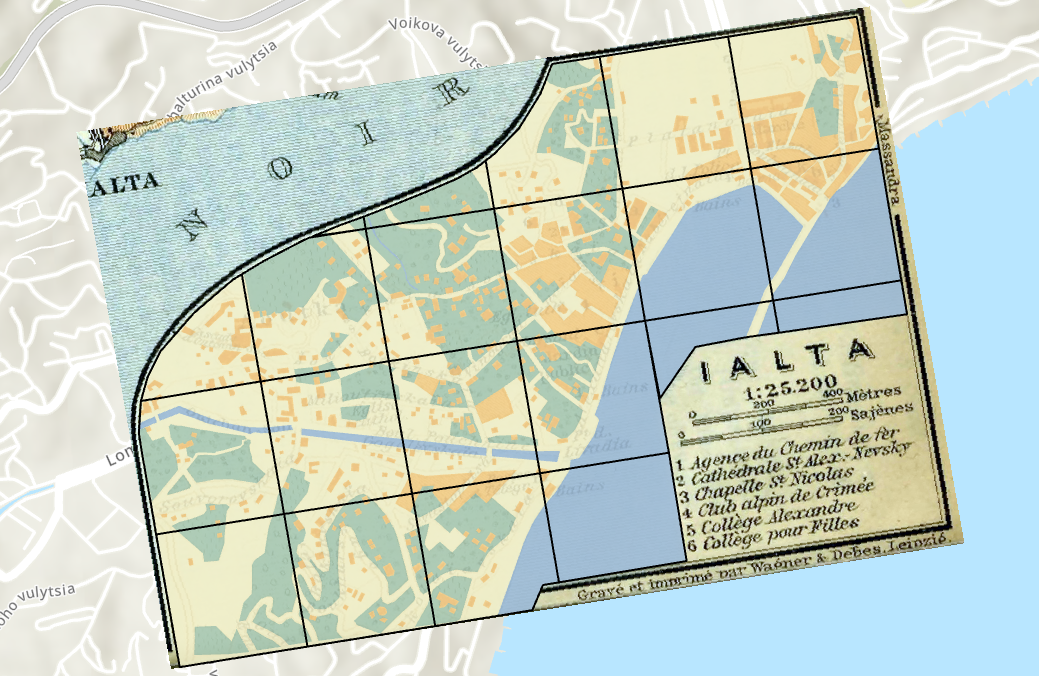
Our main source is the Baedeker guidebook to the Russian Empire (English edition, 1914). The guidebook contains 61 town plans generally at a scale of 1:30,000, all with a standardized cartography. They present an outsider's view of urban space to be sure, but they lend themselves very well to comparative analysis.One of the most exciting aspects of the project is its method: We are developing a method of calculating spatial characteristics and integrating them into an interactive web-based visualization that allows viewers to “see” and query the space of multiple towns (broken down into 700mx700m grid squares) simultaneously. Our workflow includes georeferencing, vectorization, grid application, and raster analysis (including zonal statistics to describe the percentages of buildable, built, green, “blue,” commercial, and cultural space).
As of September 2025 we have applied our method to 4 of the 6 Ukrainian towns in the set. In coming months we aim to complete this work for all Ukrainian and Finnish towns at a minimum. The goal is to create a research platform where users can explore spatial patterns and idiosyncrasies across two very different borderland regions. We will be integrating this quantitative/spatial perspective with the qualitative perspectives provided by travel accounts and other historical sources that describe the particular elements of the built environment (churches, monuments, theaters, markets, hotels, hospitals, etc.).
Pilot Visualization: Green and Built Space in Ukrainian Towns
Duration: Academic year 2025-2026Team: Kelly O'Neill; Abigail Bennett
Funding: This project is supported by a Harvard Mellon Urban Initiative grant.