Tower of Babel
1 2020-05-01T05:51:04-04:00 Kelly O'Neill dc20b45f1d74122ba0d654d19961d826c5a557f5 9 1 Full Title: Ethnographic Map of Kamchatka (Ethnographische Karte Kamtschatka's von Dittmar) // von Dittmar (1853) // Library of Congress. Catalog permalink: http://hdl.loc.gov/loc.ndlpcoop/mtfxmp.nmap039 plain 2020-05-01T05:51:04-04:00 Kelly O'Neill dc20b45f1d74122ba0d654d19961d826c5a557f5This page has tags:
- 1 2020-04-30T14:17:24-04:00 Kelly O'Neill dc20b45f1d74122ba0d654d19961d826c5a557f5 Pairing 7 (Round of Sixteen) Kelly O'Neill 8 plain 2020-05-05T16:33:59-04:00 Kelly O'Neill dc20b45f1d74122ba0d654d19961d826c5a557f5
This page is referenced by:
-
1
2020-05-01T05:22:25-04:00
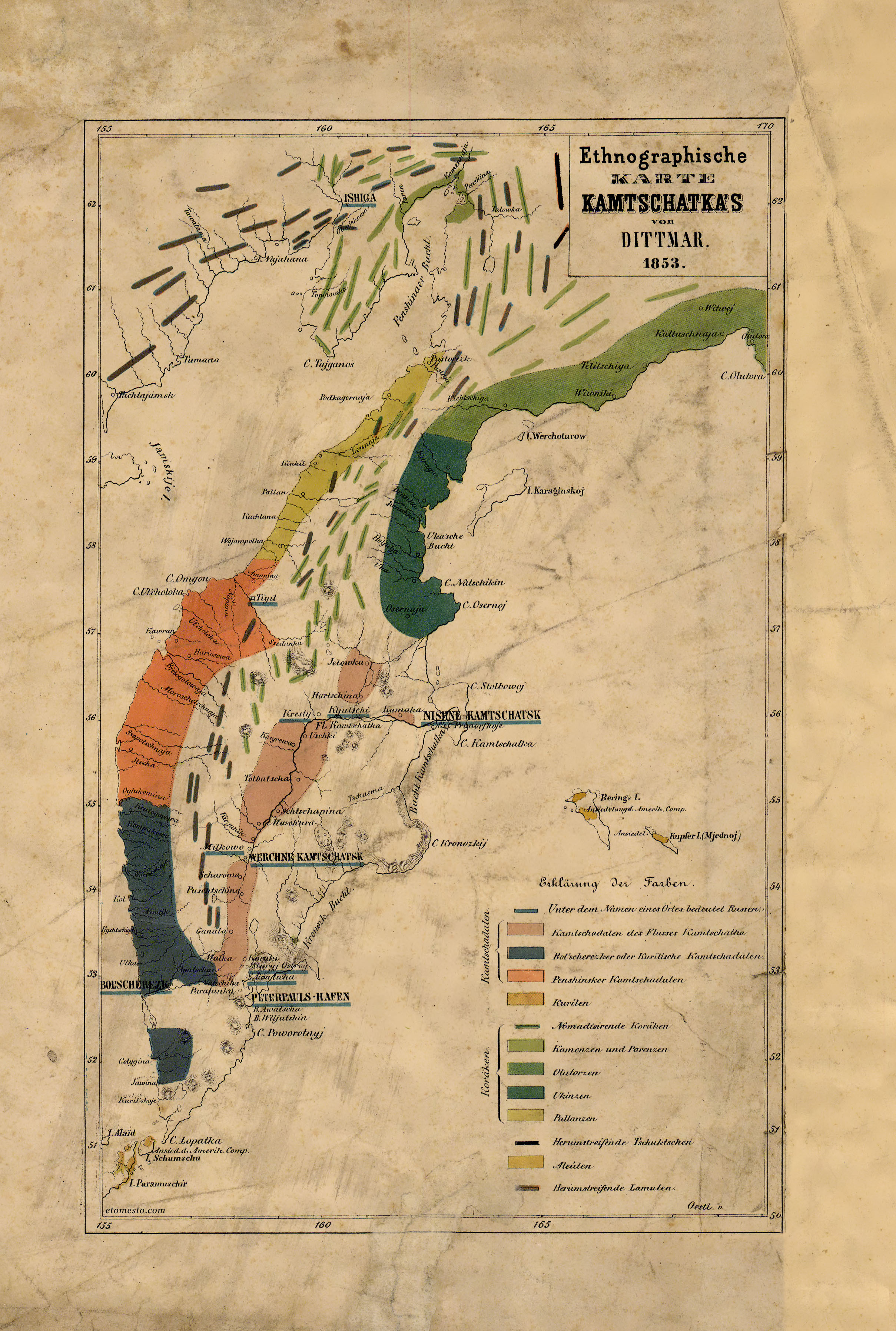
Tower of Babel
7
a dozen colors, a dozen tongues, and one map to order them all
plain
2020-05-01T15:49:56-04:00
1853
Carl von Dittmar wrote historical and ethnographic studies of the peoples of Kamchatka based on his travels there between 1851 and 1855. This map is dated 1853; he published a detailed explanation of the categories represented in the map legend in 1854. If you read German, you can consult it here (see pages 16-18).
This "modern" spin on ethnographic mapping involved not simply evoking the presence of a diverse group of peoples (which was the hallmark of a great empire in the 18th century), but imposing order on that diverse group of peoples. In a sense, von Dittmar's map is an attempt to bind certain peoples to certain spaces through washes of color (and certainly through those neat, horizontal blue lines marking Russian settlements).