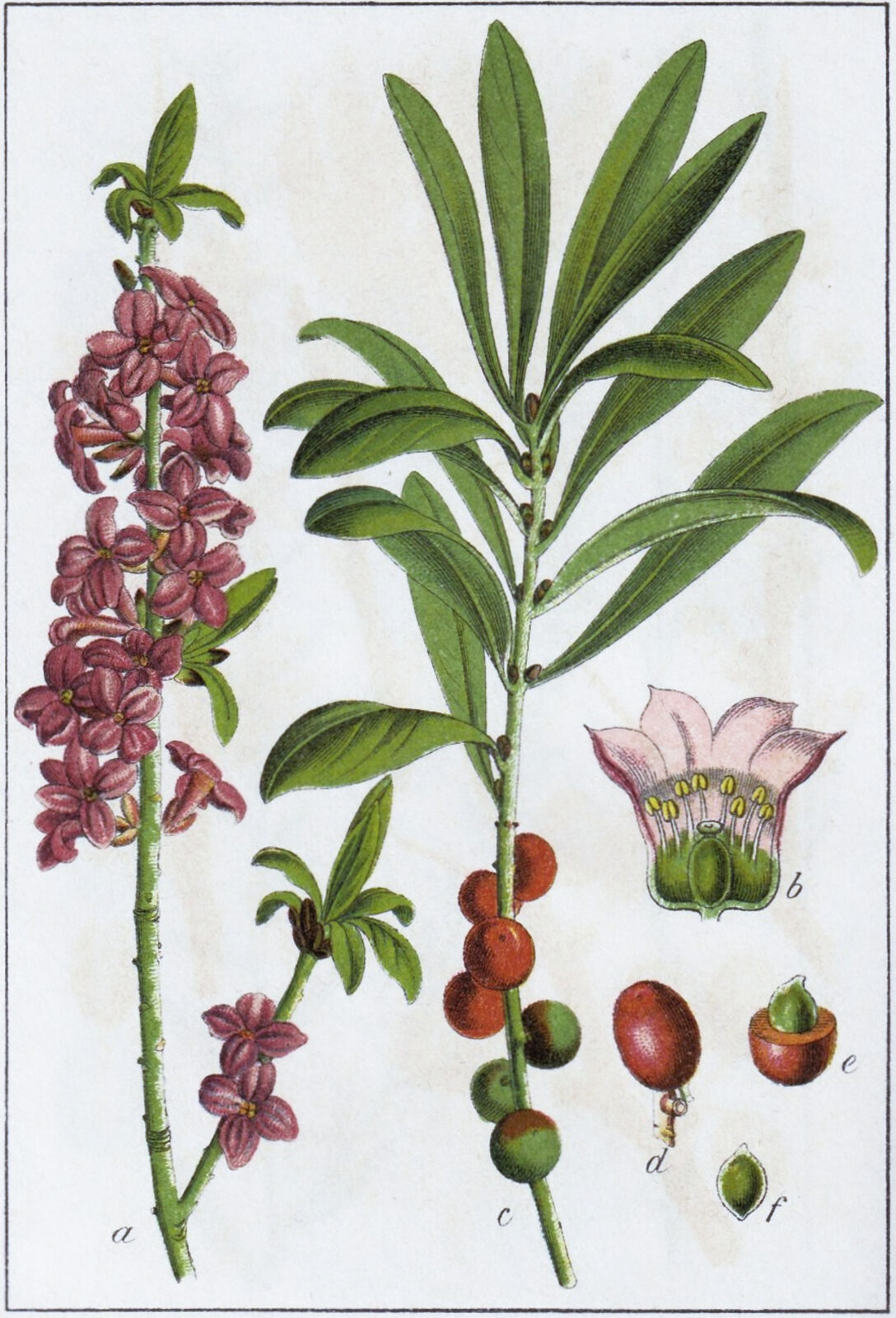
Mignonettes
1 2024-03-12T14:54:43-04:00 Paul Vadan f46fd2a7a6d2ab1ecca0ec13c84118eaf61facfa 9 3 Botanical illustration of the Yellow Mignonette, an exemplar of the Mignonette family. Mignonettes were not commonly observed near Odessa in the 1890s. plain 2024-04-04T11:09:01-04:00 Link to digital edition: https://id.lib.harvard.edu/curiosity/botanical-illustrations/62-gra00006c00477 Paul Vadan f46fd2a7a6d2ab1ecca0ec13c84118eaf61facfaThis page has tags:
- 1 2024-03-20T19:34:54-04:00 Kelly O'Neill dc20b45f1d74122ba0d654d19961d826c5a557f5 (Plant) Family Portraits Kelly O'Neill 60 structured_gallery 2025-10-15T17:44:41-04:00 Kelly O'Neill dc20b45f1d74122ba0d654d19961d826c5a557f5
This page is referenced by:
-
1
2024-03-20T15:03:28-04:00
Challenging Imperial Power... with Metadata
15
plain
2024-04-01T12:59:57-04:00
It sounds unlikely. But don't underestimate the power of (good) metadata.
In summer 2023 the Imperiia team partnered with the Harvard Map Collection on the “Undoing Empire” project. The project was awarded a Harvard Library Advancing Open Knowledge grant to sustain work across a six-month period. It had three goals:- Create a database of biodiversity in 19th-century Ukraine;
- Create an inclusive strategy for mapping historical places; and
- Develop a compelling model of collaboration between researchers and librarians for the production of high-quality geospatial data.
All of us contend with a common problem in digital scholarship: most researcher-generated datasets, which are built from a variety of archival and other materials, are not preserved for the long term in open-access library systems. Even in cases where datasets are discoverable, they are frequently missing important contextual information, such as detailed source citations or descriptions of the methods used to convert those sources into data. These problems make it nearly impossible for others to make sense of — let alone use — these pieces of scholarship.
If a book needs great footnotes, a dataset needs great metadata. But composing either one is anticlimactic at best and tedious at worst.
What if we reinvented the documentation of decision-making? What if we found a way to streamline the production of metadata? What if we developed a model for productive collaboration between researchers and librarians? What if we built real — possibly entertaining — human conversation into the process?
To that end, we tested workflows, documented practices, designed interview questions, and generally attempted to smooth the path from inception to publication of spatial data. We found that as important as it is to iterate on a data model, the best way to produce valuable data is to sit down and talk with other stakeholders.
Key Output: The Harvard Map Collection GIS Data Curation Services Template