The Imperiia ProjectMain MenuResearch Dashboardsmaps, visualizations, and moreVeles: The Data CatalogOngoing ProjectsThe MapMaker PodcastEvery story starts somewhere.Teach with MapsGalleriesKelly O'Neilldc20b45f1d74122ba0d654d19961d826c5a557f5The Imperiia Project // Davis Center for Russian and Eurasian Studies, Harvard University
Lake Onega
12019-07-12T18:43:36-04:00Kelly O'Neilldc20b45f1d74122ba0d654d19961d826c5a557f591image from Imperiia mapplain2019-07-12T18:43:36-04:00Kelly O'Neilldc20b45f1d74122ba0d654d19961d826c5a557f5
This page is referenced by:
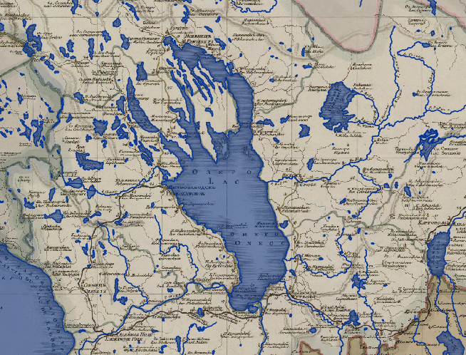
12019-07-04T00:42:41-04:00Lake Onega1gazetteer entryplain2019-07-24T03:07:11-04:00Short Universal Geography Dimensions: 210 versts long, 80 versts wide Primary inflows: the Vytegra and Volga rivers Primary outflows: the Svir River What to remember: "Lake Onega is second in size to Lake Ladoga."
New and Complete Geographical Dictionary Toponym: Onezhskoe ozero Location: in Olonets Namesnichestvo between Lake Ladoga and the White Sea Dimensions: 200 versts long, 60-80 versts wide Primary inflows: Vytegra River (from the east) Primary outflows: the Svir River What to remember: The upper reaches of the Vytegra are close to those of the Kovsha River, which flows into White Lake (Belo ozero): Badoga wharf is on the Kovsha, just 40 versts from Vytegorskaia wharf on the Vytegra. The Sheksna River flows from White Lake to the Volga. In other words, the Baltic Sea could be connected to the Caspian Sea in the following way:
the Neva > Lake Ladoga > the Svir River > Lake Onega > the Vytegra River > a canal > the Kovsha River > White Lake (Lake Beloozero) > the Sheksna River > the Volga River