The Imperiia ProjectMain MenuResearch Dashboardsmaps, visualizations, and moreVeles: The Data CatalogOngoing ProjectsThe MapMaker PodcastEvery story starts somewhere.Teach with MapsGalleriesKelly O'Neilldc20b45f1d74122ba0d654d19961d826c5a557f5The Imperiia Project // Davis Center for Russian and Eurasian Studies, Harvard University
Dnepr estuary
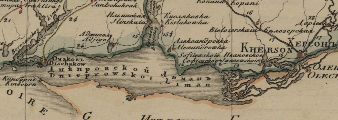
12019-07-22T18:58:29-04:00Kelly O'Neilldc20b45f1d74122ba0d654d19961d826c5a557f591image from the Geographical Atlas; Kherson Province; sheet #16, published 1821plain2019-07-22T18:58:29-04:00Kelly O'Neilldc20b45f1d74122ba0d654d19961d826c5a557f5
This page is referenced by:
12019-07-18T13:48:18-04:00Dnieper estuary2gazetteer entryplain2020-04-27T20:47:38-04:00Short Universal Geography Toponym: Dneprovskij liman
New and Complete Geographical Dictionary (part 1, pages 251-252) [No separate attestation for the estuary. The entry for the river, however, describes the liman, which is also identified as a bay.] Dimensions: 60 versts long; between 2 and 10 versts wide