The Imperiia ProjectMain MenuResearch Dashboardsmaps, visualizations, and moreVeles: The Data CatalogOngoing ProjectsThe MapMaker PodcastEvery story starts somewhere.Teach with MapsGalleriesKelly O'Neilldc20b45f1d74122ba0d654d19961d826c5a557f5The Imperiia Project // Davis Center for Russian and Eurasian Studies, Harvard University
Kharkiv Cover Map
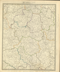
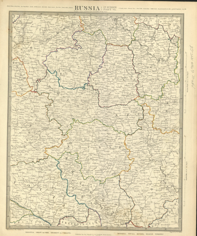
12018-03-06T04:29:53-05:00desmond goodwin8f8889a0403a53b0c51d2955c49c517867d152fb91plain2018-03-06T04:30:41-05:00desmond goodwin8f8889a0403a53b0c51d2955c49c517867d152fbThis picture, used as the cover page for the Kharkiv section and displayed here, is a picture of the borderlands between the Polish-Lithuanian Commonwealth and the Russian Empire before the 1772 partitions. It is unclear where the border is shown exactly, but the Kharkiv province is depicted on this map, as well as the city of Kharkiv. The map shows all of the roads leading in and out of Kharkiv, illustrating how Kharkiv is central to the province and exemplifies its status of the administrative center of the province. This map is a part of a larger collection of “Russia in Europe” maps published in 1845. The map is in English and the bottom of the map states “Published by Charles Knight and Co. London”.
This page references:
12018-03-06T03:34:23-05:00Kharkov map 17721Published in 1845 larger collection of Russian maps by English cartographerplain2018-03-06T03:34:23-05:00