The Imperiia Project: a spatial history of the Russian EmpireMain MenuProjectsDashboardsData CatalogMapStoriesGalleriesGamesWho said history was boring?Teach Our ContentCiting the ProjectKelly O'Neilldc20b45f1d74122ba0d654d19961d826c5a557f5The Imperiia Project // Davis Center for Russian and Eurasian Studies, Harvard University
Kharkov and Adminsitrative Reorganization
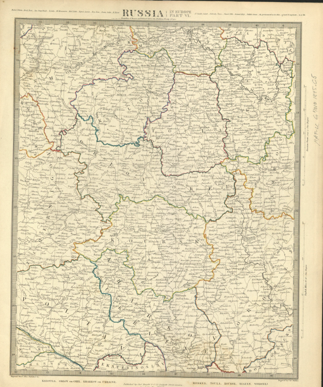
12018-03-06T00:45:52-05:00desmond goodwin8f8889a0403a53b0c51d2955c49c517867d152fb91image_header2018-03-10T02:00:47-05:00desmond goodwin8f8889a0403a53b0c51d2955c49c517867d152fbFollowing the partitions of Poland and the annexation of Crimea towards the end of the eighteenth century, all of Ukraine was split between the Russian Empire and the Austrian Empire. The Russian Empire referred to their chunk as “Dnieper Ukraine”. In 1775, Catherine had administered another set of reforms, similar the ones of 1765, that reorganized the Ukrainian regions of the Empire. She divided up the region into smaller provinces called namestnichestvo, meaning “imperial province”. In 1802, Emperor Alexander replaced the namestnichestvo with an even smaller provincial unit called the guberniia, meaning province. The Kharkov province, which was most of former Sloboda Ukraine, included the city of Kharkov, which remained the administrative center for the region. The ethnicity of the province was largely Ukrainian, which includes Cossacks. The governor of Kharkov, gubernator, reported to St. Petersburg. Police and gentry were stationed in the provinces, and assemblies were established that included members of the Russian nobility. This region of the Empire became a very important market region. Good manufactured in central Russia were brought to the Dneiper Ukraine annual market fairs. Kharkov was one of the four most important market locations for the Empire, with its annual fairs lasting as long as four months.