The Imperiia Project: a spatial history of the Russian EmpireMain MenuProjectsDashboardsData CatalogMapStoriesGalleriesGamesWho said history was boring?Teach Our ContentCiting the ProjectKelly O'Neilldc20b45f1d74122ba0d654d19961d826c5a557f5The Imperiia Project // Davis Center for Russian and Eurasian Studies, Harvard University
Convergence
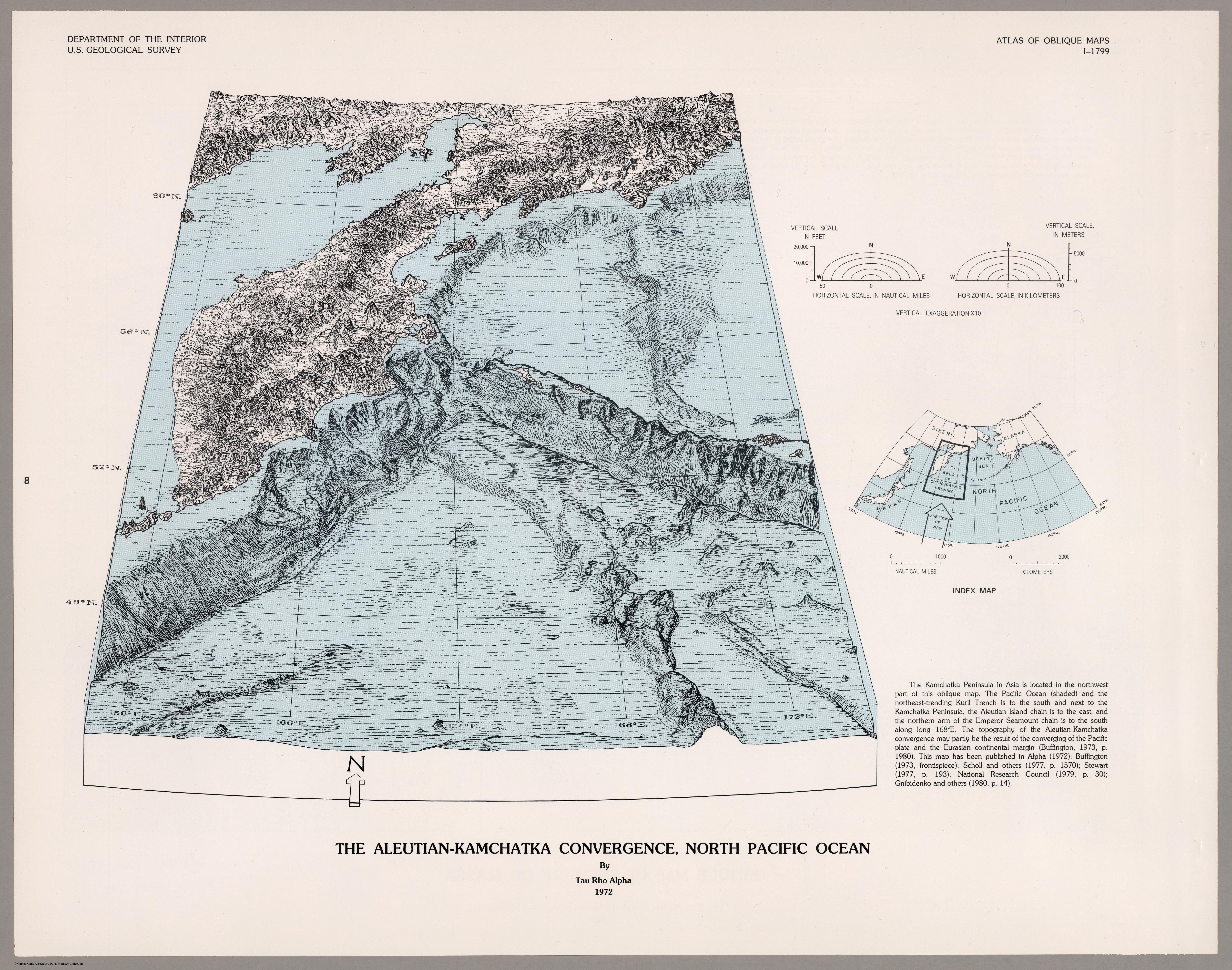
12020-05-01T05:37:26-04:00Kelly O'Neilldc20b45f1d74122ba0d654d19961d826c5a557f591Full Title: The Aleutian-Kamchatka Convergence, North Pacific Ocean // U. S. Geological Survey (Reston, 1972) // David Rumsey Map Collection. Catalog permalink: https://www.davidrumsey.com/luna/servlet/s/hzu142plain2020-05-01T05:37:26-04:00Kelly O'Neilldc20b45f1d74122ba0d654d19961d826c5a557f5
This page has tags:
12020-04-30T14:17:14-04:00Kelly O'Neilldc20b45f1d74122ba0d654d19961d826c5a557f5Pairing 6 (Round of Sixteen)Kelly O'Neill5plain2020-05-05T16:29:13-04:00Kelly O'Neilldc20b45f1d74122ba0d654d19961d826c5a557f5
This page is referenced by:
12020-05-01T05:19:15-04:00Convergence5in which the ocean drains away and the truth of the world is revealedplain2020-05-05T16:27:51-04:001972A map made in the U.S.A.! It was published in the Atlas of Oblique Maps, A Collection of Landform Portrayals of Selected Areas of the World - a volume of oblique views produced by the U.S. Geological Survey.
If you were skeptical about the notion that Aleutian Islands and Kamchatka were really all that intimately connected, this is the map for you. What the oceans obscure is laid bare: the geographical sweet-spot where the Kuril Trench meets the Aleutian Island chain.
If you look closely at the Aleutian chain, you will see the Near Islands and Commander Islands (with Bering Island closest to Kamchatka) rising up out of the water.