Gardens of Crimea
What if we could reconstruct the fabled gardens of Crimea as they were at the turn of the 19th century?
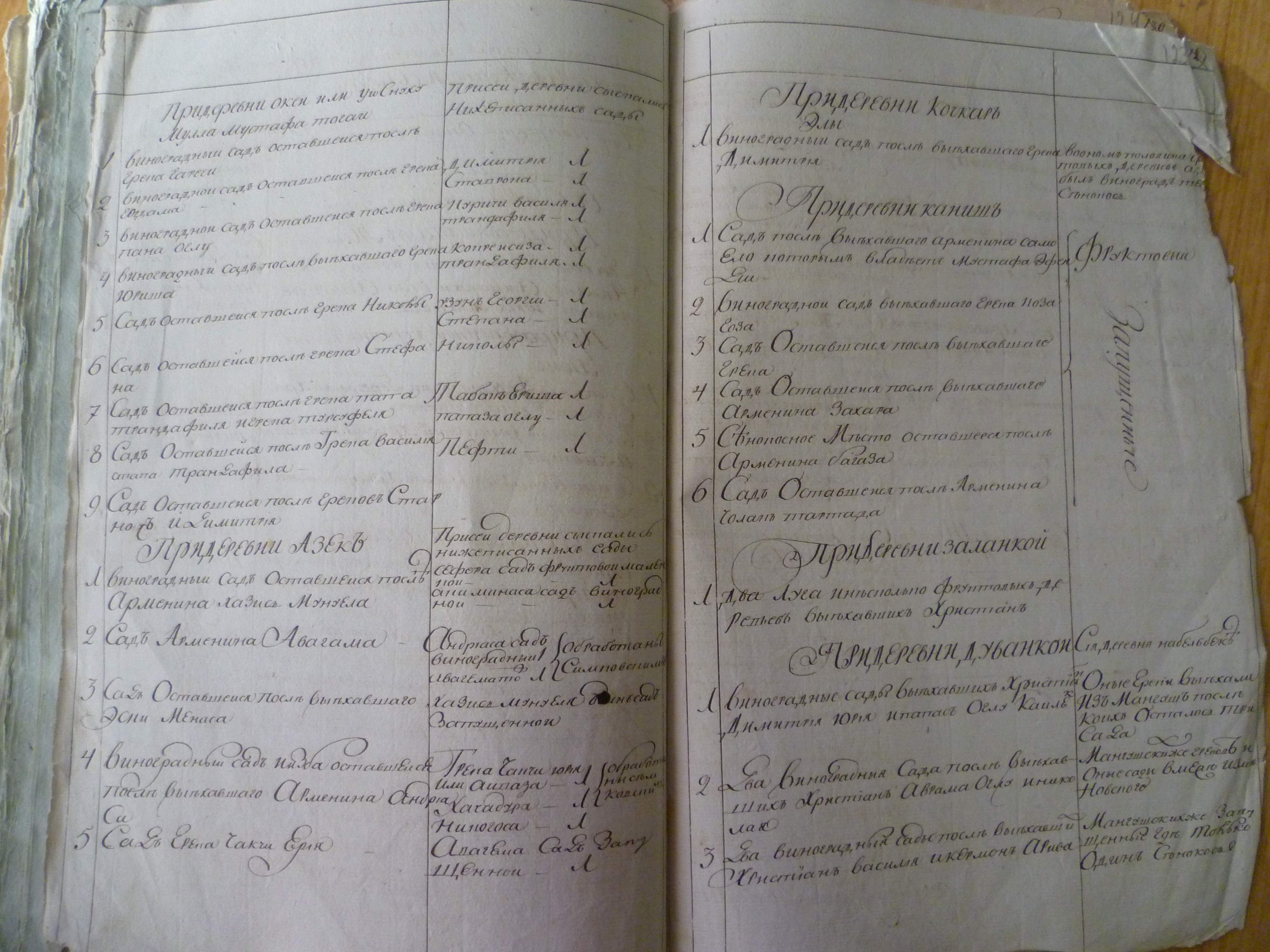
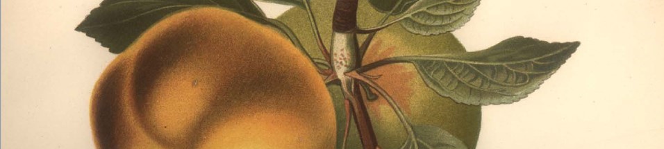
Sometimes, the historical record allows us to attempt the impossible. Ten years after the (first) annexation of Crimea by Russia, imperial officials undertook a survey of the most valuable properties in the newly-acquired territory: its gardens. To be more precise, the survey focused on the orchards and vineyards abandoned by their owners (Crimean Tatars and Greeks) and claimed as state property after 1783. The work was carried out between 1791 and 1793 and by the time it was complete, officials had compiled reports describing 809 orchards, 332 vineyards, 19,667 trees, and almost a quarter million grapevines. The registers provide glimpses of gardens that have long since ceased to exist. They allow us to imagine the cycles of sunlight and shade, the aromas, the varying levels of wildness and cultivation. At first glance we see a landscape of plum and hazelnut, walnut and pear. There are peaches and cherries, medlars and quince, and even a rogue almond. It seems beautiful. Lush. We aren't surprised that a traveler writing about Alupka in 1815 waxed poetic about the figs and cypressand everywhere the wonderful rose bushes, lavender, jasmine and lilies, such that I thought I was in Italy.
But there are many ways to read a garden.
Piles of rotting fruit amass in autumn as surely as the sweet-blooming flowers cluster in spring. Trees fall victim to pest and drought and old age. Winds blow, axes fall. Those unwritten stories remain beyond our view.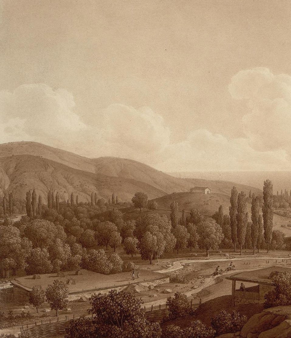
However, the documents we do have tell stories of abundance and abandonment, persistence and transition. How do they manage this?
In the quirky set of registers at the heart of this project, each entry describes a garden whose owner fled Crimea between 1778 and 1791. Greek owners emigrated in 1778 in response to Catherine II's invitation to resettle in Russian territory near Mariupol. Tatar owners emigrated after Catherine annexed the Crimean Khanate in 1783. The men, together with their families, their knowledge of the soil, their irrigation practices, their tastes for fruit and shade, left the land. Their orchards and vineyards remained behind - spaces of loss and ruin as well as nodes of productivity.
And in the botanical dictionaries that bookend this project, extending it into the early years of the 20th century, we learn that fruits fell into two categories: those that had thrived on the peninsula for centuries and yet struggled to earn a place in imperial trade, and those introduced by experts precisely because of their established market value. Merchants and pomologists cheered the (slow) transformation of Crimea's wild orchards, with their chaotic assortment of trees and vines, into ordered, productive, predictable spaces. But others looked on and wondered about the cost of taming the landscape.
Dashboard Components
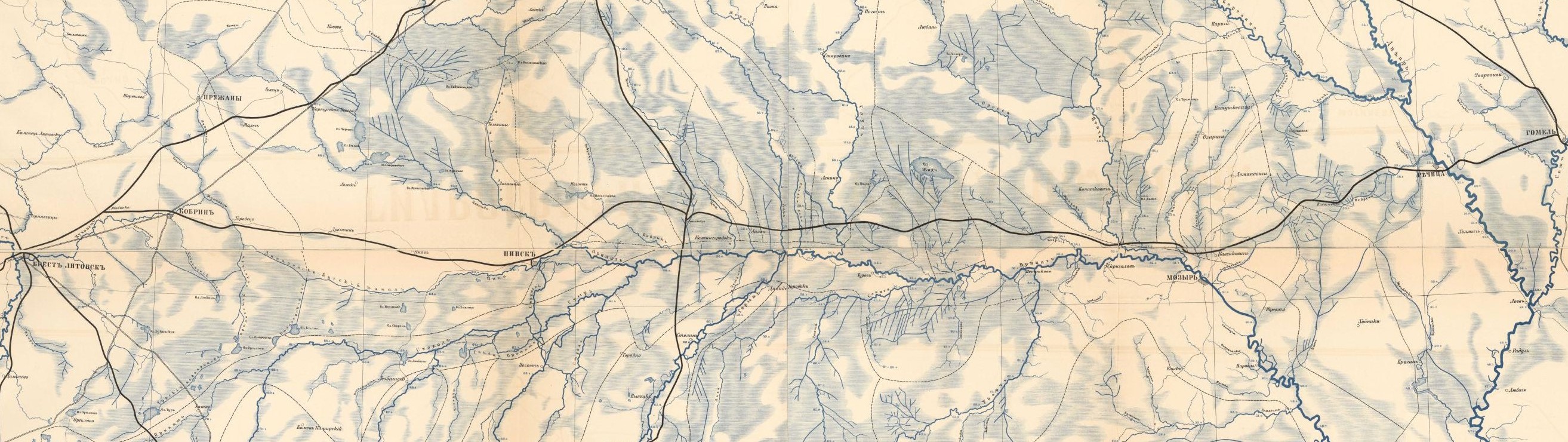
The Glorious (Fruit Tree) Glossary: Explore the tree varieties mentioned in the registers. The Glossary includes notes from the dataset (see below) and bits of color commentary from an 18-century naturalist.The Orchard Locator: Use an early nineteenth-century map to locate the villages associated with each orchard.
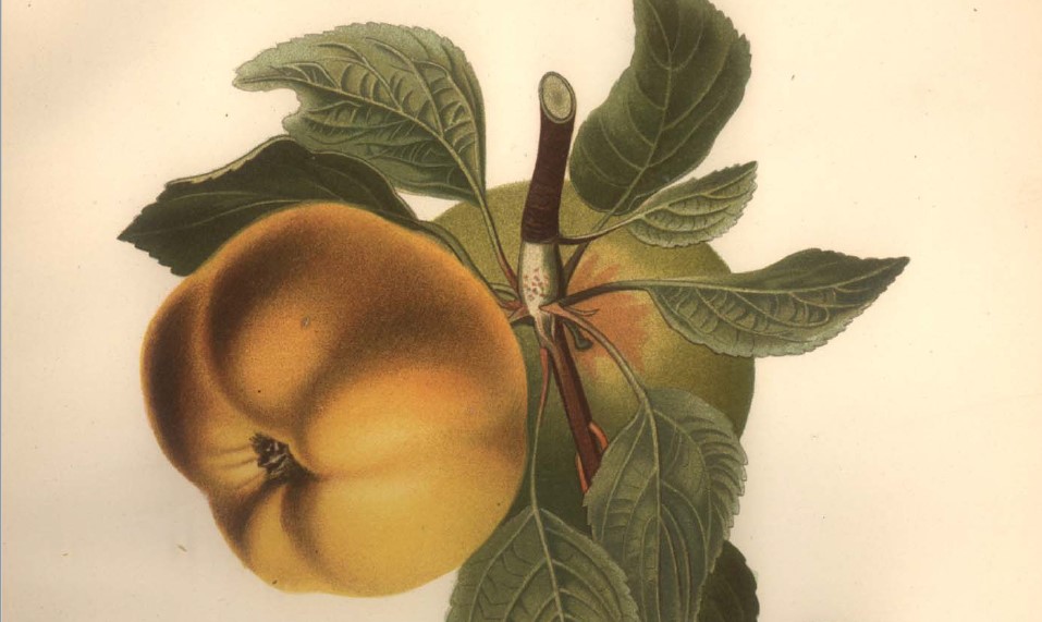
The Tasting Board: Consult botanical illustrations and flavor notes for Crimean apples, pears, plums, and cherries.
The Vineyard mApp: This interactive map includes layers showing vineyards, rivers, and forested land. It allows you to look at varying grapevine and tree densities and compare the distribution of tree types in the orchards.
Access the related dataset via the Data Catalog.
Consult the Empire of Fruit map.
Check the index of botanical illustrations.